MyTopo
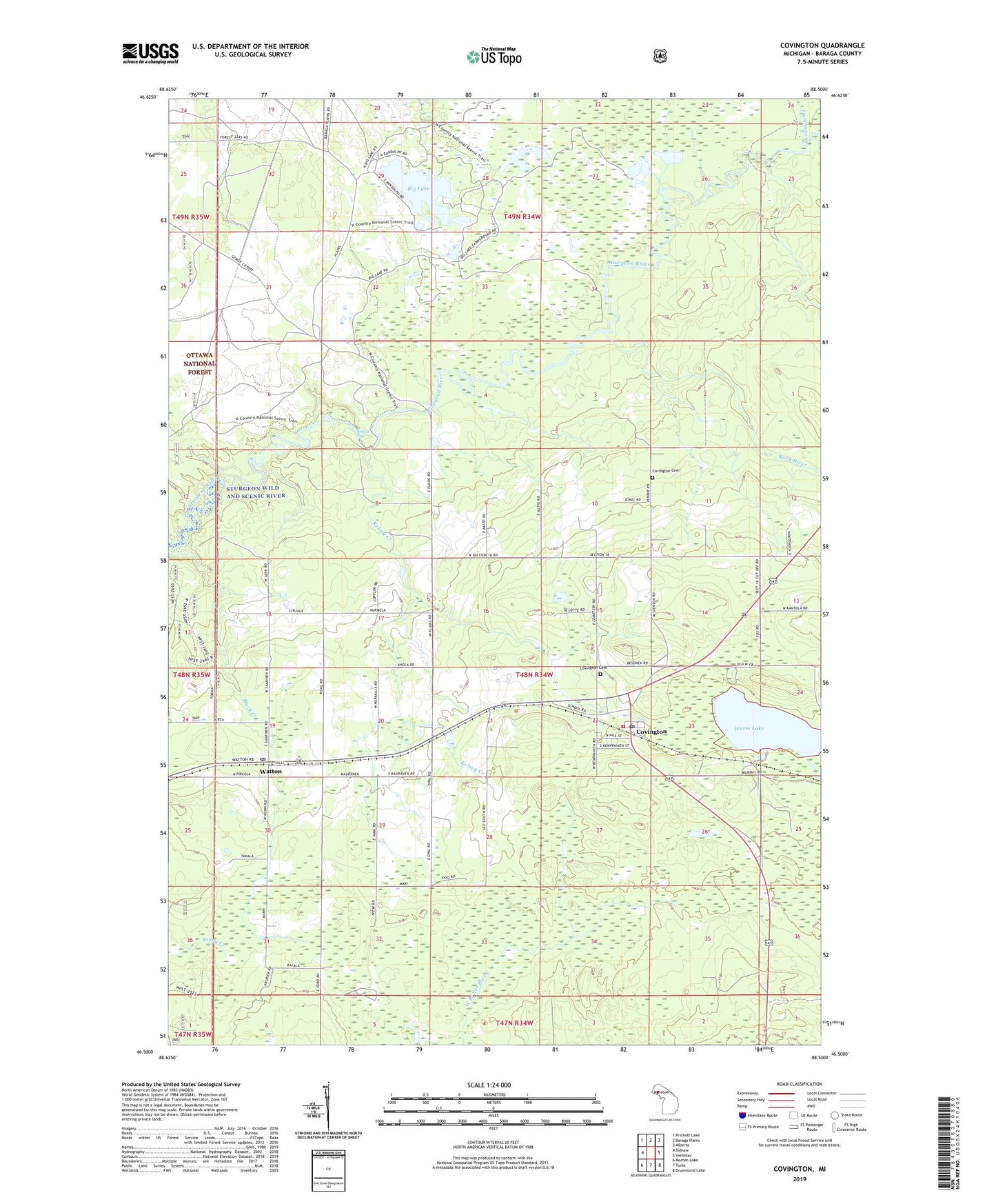
Covington Michigan US Topo Map
Couldn't load pickup availability
Also explore the Covington Forest Service Topo of this same quad for updated USFS data
2023 topographic map quadrangle Covington in the state of Michigan. Scale: 1:24000. Based on the newly updated USGS 7.5' US Topo map series, this map is in the following counties: Baraga. The map contains contour data, water features, and other items you are used to seeing on USGS maps, but also has updated roads and other features. This is the next generation of topographic maps. Printed on high-quality waterproof paper with UV fade-resistant inks.
Quads adjacent to this one:
West: Sidnaw
Northwest: Prickett Lake
North: Baraga Plains
Northeast: Alberta
East: Vermilac
Southeast: Drummond Lake
South: Tunis
Southwest: Marten Lake
This map covers the same area as the classic USGS quad with code o46088e5.
Contains the following named places: Baraga Plains Waterfowl Management Area, Bethany Lutheran Church, Big Lake, Covenant Church, Covington, Covington Cemetery, Covington Census Designated Place, Covington Post Office, Covington Rest Home, Covington Station, Covington Township Emergency Medical Services, Covington Township Volunteer Fire Department, Jacob and Anna Leinonen Homestead Historical Marker, Kelsey Creek, Lateral Creek, Murphy Post Office, Murphy River, Murphy Station, Plumbago Creek, Rock River, Tibbets Falls, Township of Covington, Trinity Church, Watton, Watton Apostolic Lutheran Church, Watton Post Office, Watton Station, ZIP Code: 49970