MyTopo
Aurelius Michigan US Topo Map
Couldn't load pickup availability
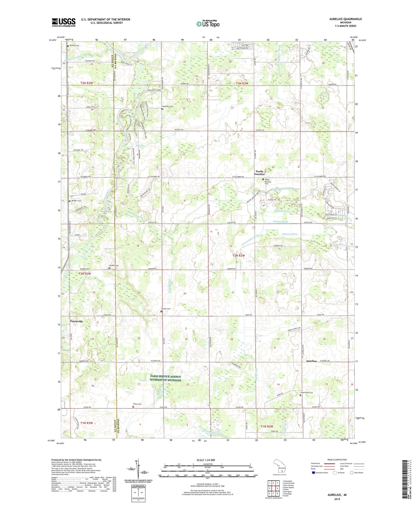
2019 topographic map quadrangle Aurelius in the state of Michigan. Scale: 1:24000. Based on the newly updated USGS 7.5' US Topo map series, this map is in the following counties: Ingham, Eaton. The map contains contour data, water features, and other items you are used to seeing on USGS maps, but also has updated roads and other features. This is the next generation of topographic maps. Printed on high-quality waterproof paper with UV fade-resistant inks.
Quads adjacent to this one:
West: Eaton Rapids
Northwest: Dimondale
North: Lansing South
Northeast: East Lansing
East: Mason
Southeast: Leslie
South: Onondaga
Southwest: Springport
Contains the following named places: Abbott Drain, Aurelius, Aurelius and Delhi Drain, Aurelius Baptist Church, Aurelius Post Office, Aurelius Township Hall, Bergeon Field, Blakslee Drain, Branson Bay Golf Course, Bunker Cemetery, Columbia Creek, Columbia Creek Park, Columbia Road Baptist Church, County Line Drain, Fowler Cemetery, Fowler Drain, Grace Church, Grand River County Park, Greenwood Cemetery, Gretton Drain, Grovenburg Church, Hart Branch, Holley and Day Drain, Jehovah's Witnesses, Kenfield Drain, Markham Cemetery, Marshall and Hayes Drain, Mud Lake, Munger Cemetery, North Aurelius, North Aurelius Cemetery, North Aurelius Elementary School, North Aurelius Post Office, Oaks Drain, Osborne Drain, Petreville Post Office, Petrieville, Plains Cemetery, Plains Church, Robbins Church, Skinner Cemetery, Skinner Extension Drain, Topliff Drain, Township of Aurelius, West Aurelius Drain, West Columbia Church, Windmill Mobile Home Park, Wright and Potter Drain