MyTopo
Camden Michigan US Topo Map
Couldn't load pickup availability
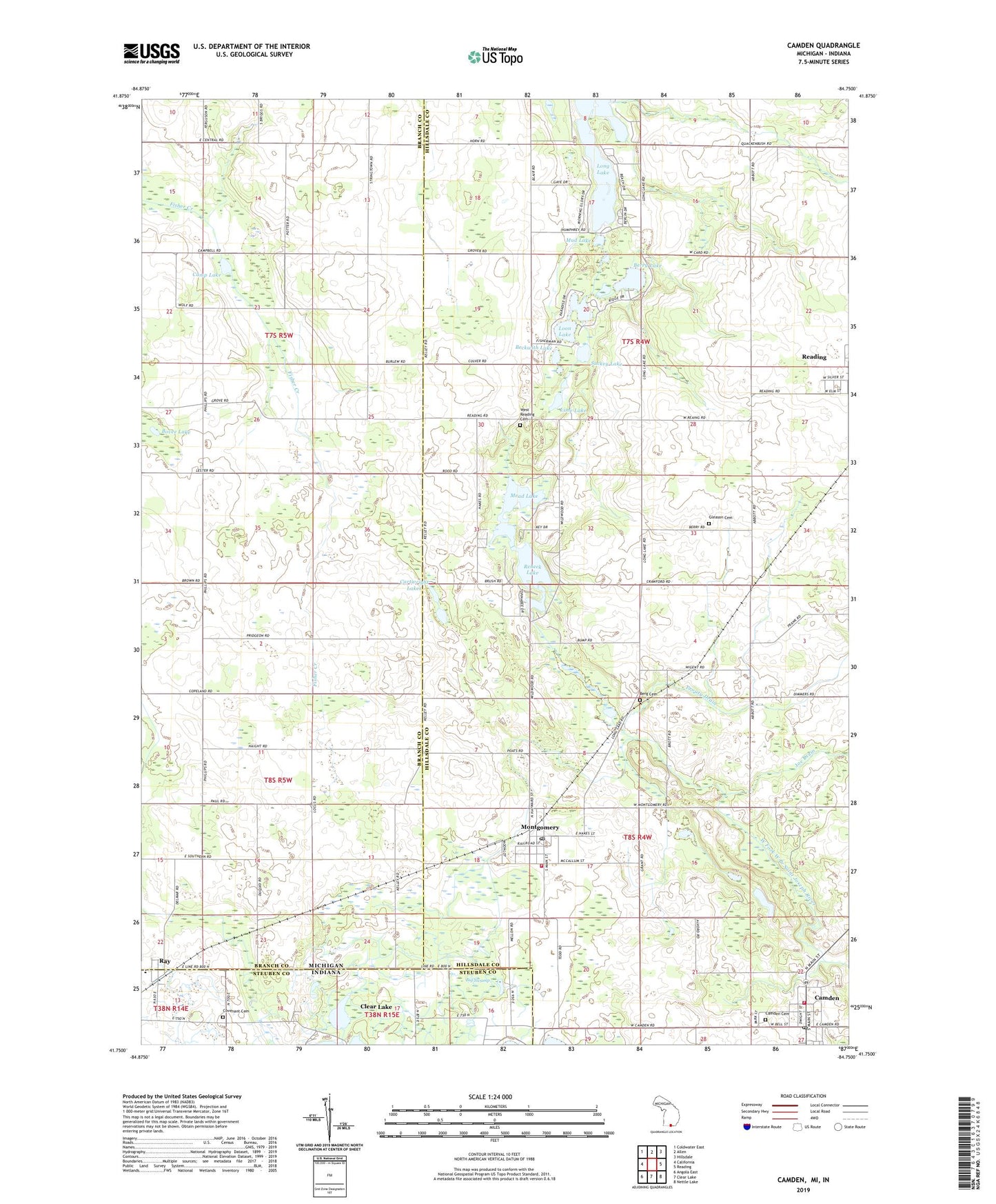
2019 topographic map quadrangle Camden in the states of Michigan, Indiana. Scale: 1:24000. Based on the newly updated USGS 7.5' US Topo map series, this map is in the following counties: Hillsdale, Branch, Steuben. The map contains contour data, water features, and other items you are used to seeing on USGS maps, but also has updated roads and other features. This is the next generation of topographic maps. Printed on high-quality waterproof paper with UV fade-resistant inks.
Quads adjacent to this one:
West: California
Northwest: Coldwater East
North: Allen
Northeast: Hillsdale
East: Reading
Southeast: Nettle Lake
South: Clear Lake
Southwest: Angola East
Contains the following named places: Allen Lake, Barre Field, Beckwith Lake, Berg Cemetery, Berry Lake, Big Swamp, Bovee Lake, Camden, Camden Cemetery, Camden Community Field, Camden Fire Department, Camden Missionary Church, Camden Post Office, Camden Township Library, Camden United Methodist Church, Camp Lake, Cartwright Lakes, Covenant Cemetery, East Alganssee Church, Gleason Cemetery, Hillsdale Medical Clinic, Joe Drain, Kimball Camp, Lime Lake, Lime Lake Campground, Long Lake, Loon Lake, Mead Lake, Montgomery, Montgomery Fire Department Station 7, Montgomery Post Office, Montgomery Station, Montgomery United Brethren Church, Montgomery United Methodist Church, Mud Lake, Paw Paw Lake, Prouty Drain, Ray, Rebeck Lake, Suckey Lake, Township of Camden, Township of Reading, Turner Lake, Village of Camden, Village of Montgomery, West Reading Cemetery, West Reading Church, ZIP Codes: 49255, 49274