MyTopo
Reading Michigan US Topo Map
Couldn't load pickup availability
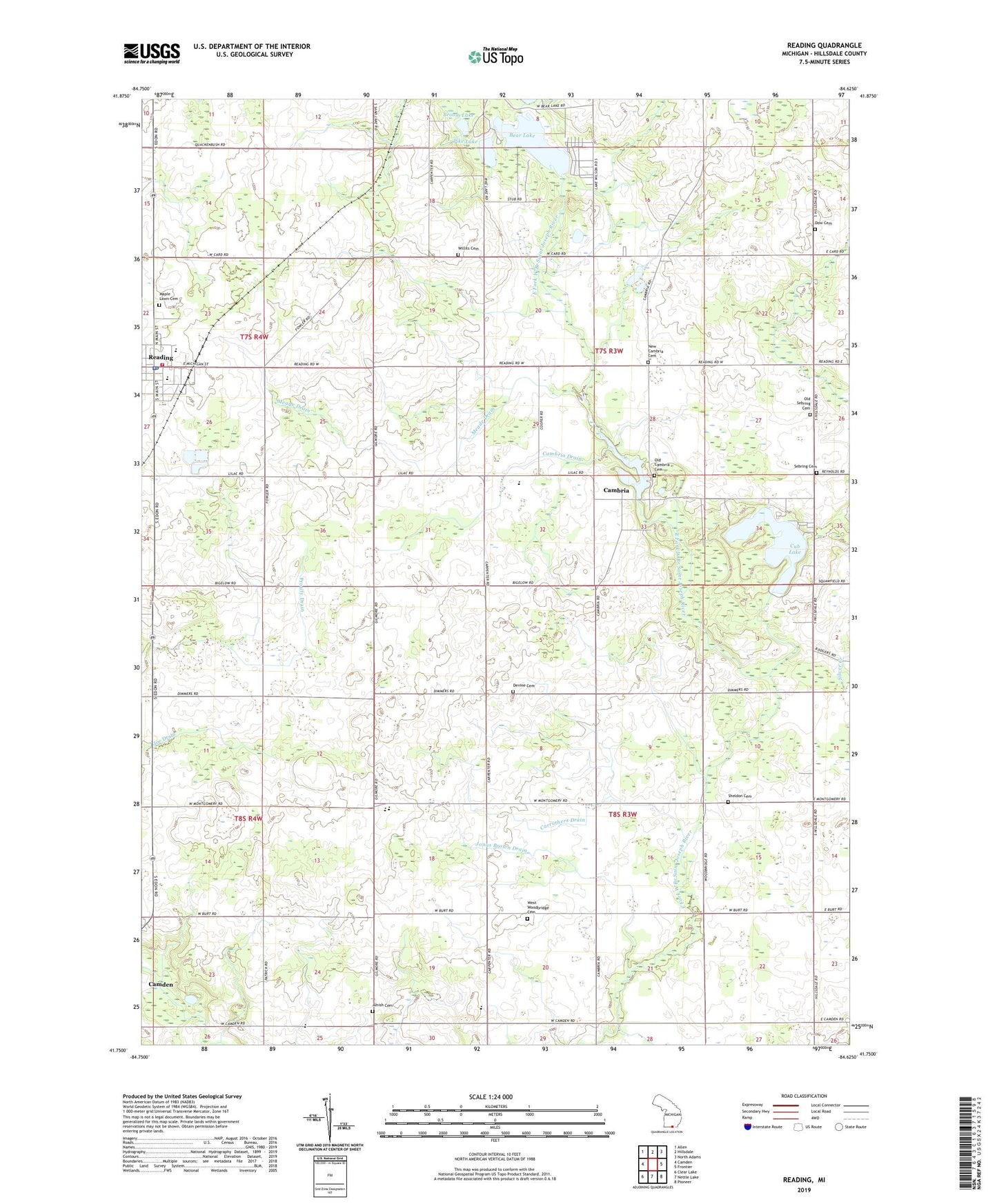
2023 topographic map quadrangle Reading in the state of Michigan. Scale: 1:24000. Based on the newly updated USGS 7.5' US Topo map series, this map is in the following counties: Hillsdale. The map contains contour data, water features, and other items you are used to seeing on USGS maps, but also has updated roads and other features. This is the next generation of topographic maps. Printed on high-quality waterproof paper with UV fade-resistant inks.
Quads adjacent to this one:
West: Camden
Northwest: Allen
North: Hillsdale
Northeast: North Adams
East: Frontier
Southeast: Pioneer
South: Nettle Lake
Southwest: Clear Lake
This map covers the same area as the classic USGS quad with code o41084g6.
Contains the following named places: Adams School, Amish Cemetery, Amish School, Bear Lake, Broom Lake, Cambria, Cambria Baptist Church, Cambria Census Designated Place, Cambria Drain, Cambria Millpond, Cambria Post Office, Camden-Frontier School, Carruthers Drain, Church of the Nazarene, City of Reading, Cub Lake, Devine Cemetery, Dow Cemetery, Jonas Brown Drain, Maple Lawn Cemetery, Meade Drain, New Cambria Cemetery, New Hope Church, Old Cambria Cemetery, Old Sebring Cemetery, Pike Lake, Reading, Reading City Hall, Reading Community Fire Department, Reading Community Library, Reading Elementary School, Reading Emergency Unit Station 1, Reading Health Clinic, Reading High School, Reading Police Department, Reading Post Office, Reading Station, Reading United Methodist Church, Rotary Park, Sebring Cemetery, Sheldon Cemetery, South Woodbridge Church, Township of Cambria, Township of Woodbridge, Water Works Park, West Woodbridge Cemetery, West Woodbridge Church, Willits Cemetery