MyTopo
Carney Lake Michigan US Topo Map
Couldn't load pickup availability
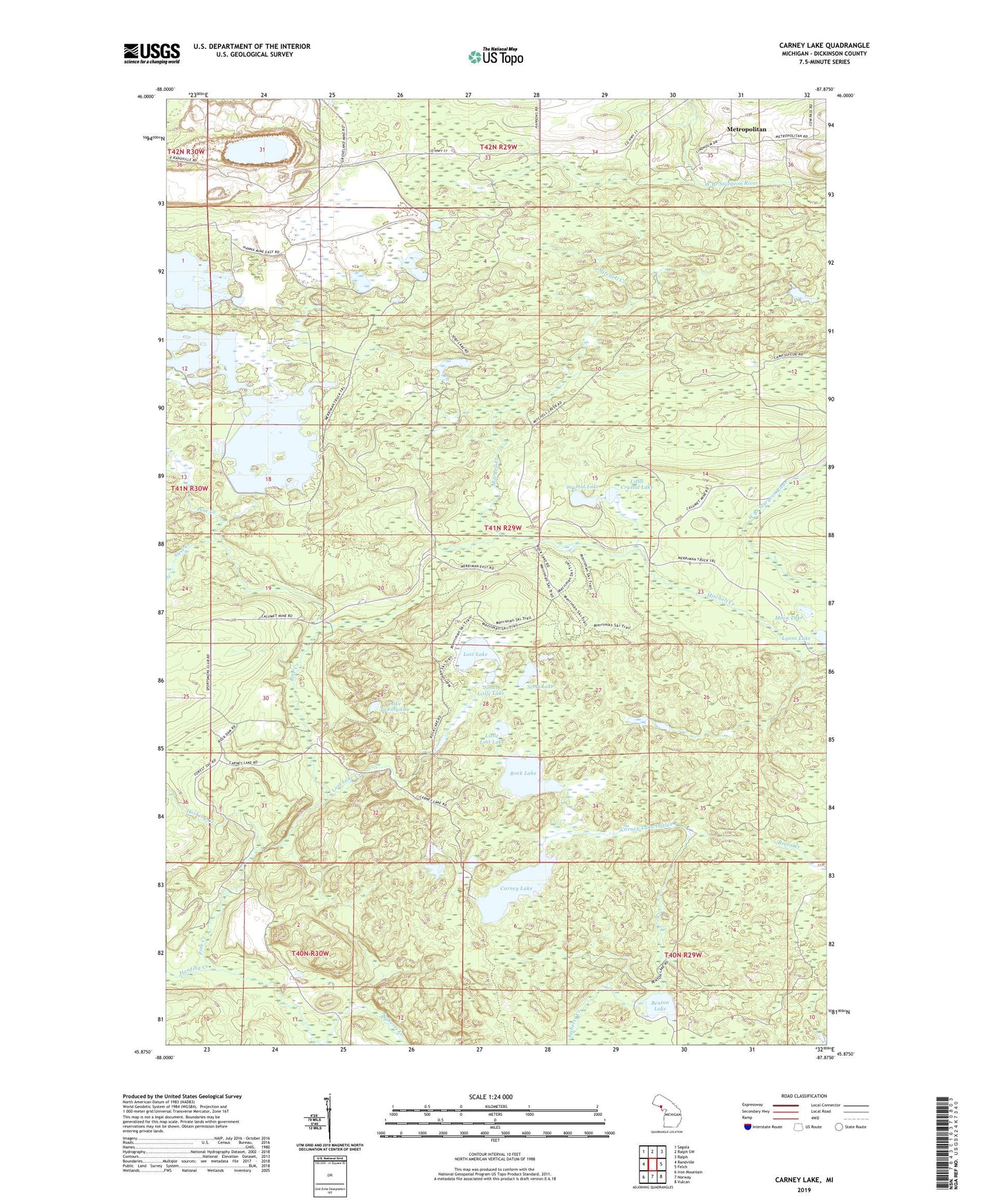
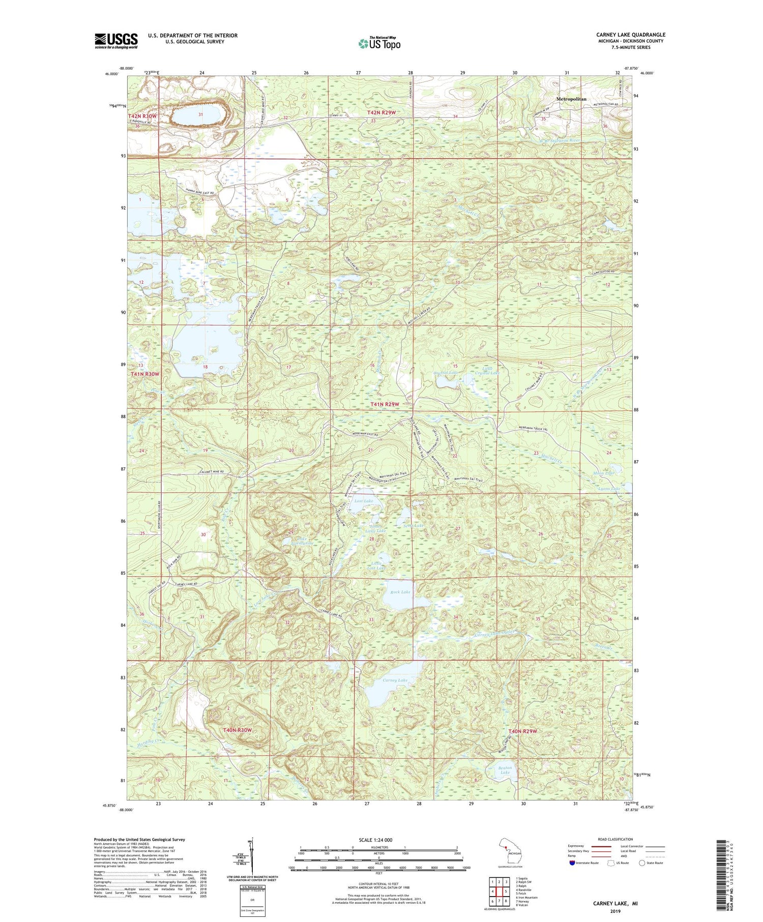
2019 topographic map quadrangle Carney Lake in the state of Michigan. Scale: 1:24000. Based on the newly updated USGS 7.5' US Topo map series, this map is in the following counties: Dickinson. The map contains contour data, water features, and other items you are used to seeing on USGS maps, but also has updated roads and other features. This is the next generation of topographic maps. Printed on high-quality waterproof paper with UV fade-resistant inks.
Quads adjacent to this one:
West: Randville
Northwest: Sagola
North: Ralph SW
Northeast: Ralph
East: Felch
Southeast: Vulcan
South: Norway
Southwest: Iron Mountain
Contains the following named places: Benton Lake, Carney Lake, Carney Lake Outlet, Carney Lake State Forest Campground, Crystal Lake, Groveland Mine, Harding Creek, Hosking Creek, Johns Little Lake, Lake Twentynine, Little Crystal Lake, Little Lost Lake, Lost Lake, Lost Lake Creek, Metropolitan, Metropolitan Post Office, Metropolitan Station, Mitchell Creek, Moon Lake, Rock Lake, Scott Lake, Steel Creek, Toby Lake, Toms Lake, ZIP Code: 49801