MyTopo
Felch Michigan US Topo Map
Couldn't load pickup availability
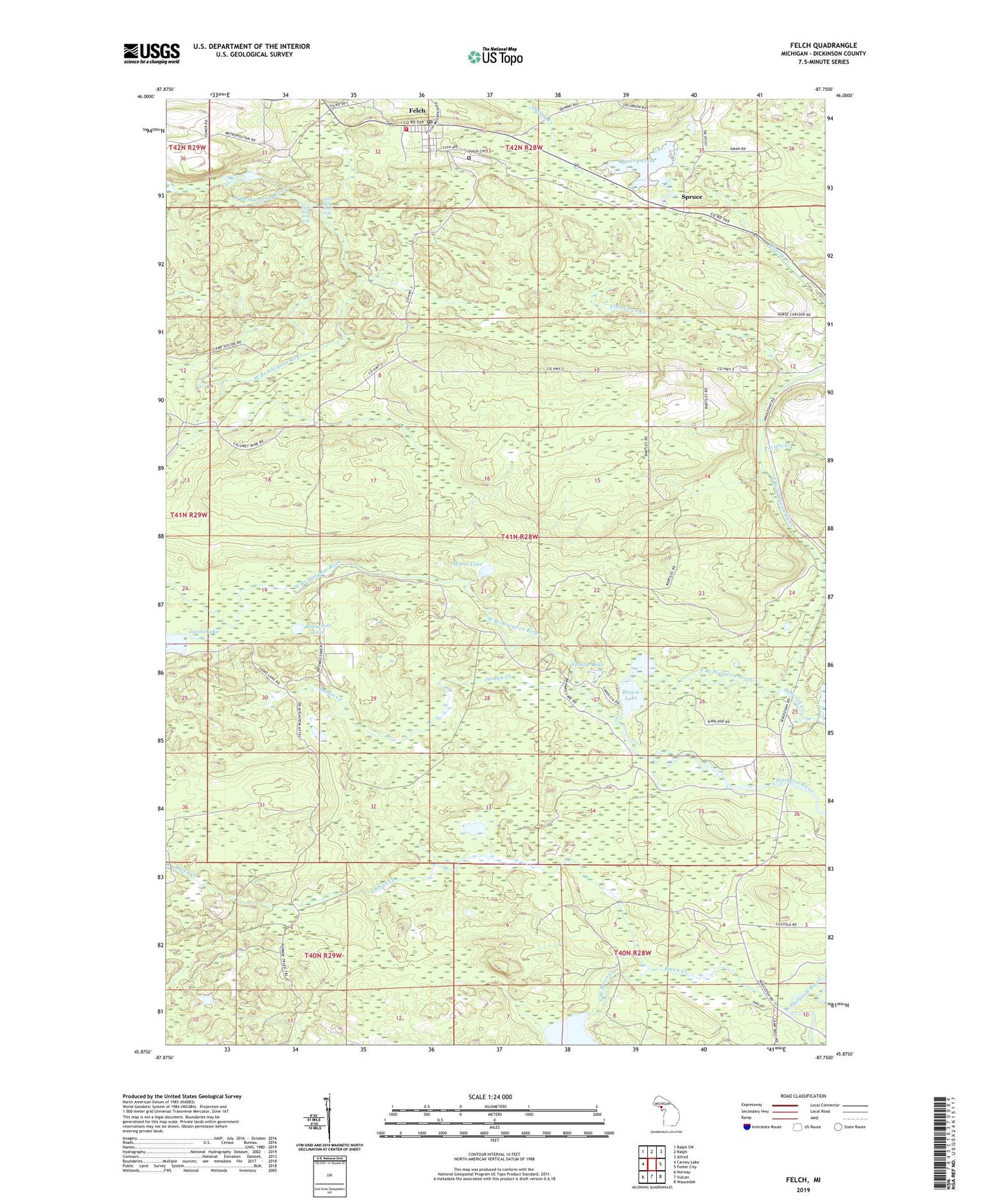
2023 topographic map quadrangle Felch in the state of Michigan. Scale: 1:24000. Based on the newly updated USGS 7.5' US Topo map series, this map is in the following counties: Dickinson. The map contains contour data, water features, and other items you are used to seeing on USGS maps, but also has updated roads and other features. This is the next generation of topographic maps. Printed on high-quality waterproof paper with UV fade-resistant inks.
Quads adjacent to this one:
West: Carney Lake
Northwest: Ralph SW
North: Ralph
Northeast: Alfred
East: Foster City
Southeast: Waucedah
South: Vulcan
Southwest: Norway
This map covers the same area as the classic USGS quad with code o45087h7.
Contains the following named places: Breen Creek, Brown Lake, Calumet Mine, East Branch Sturgeon River, Felch, Felch Cemetery, Felch Post Office, Felch Station, Felch Township Volunteer Fire Department, Finn Town Creek, Hancock Creek, Hancock Creek Flowage, Jansen Creek, Lost Lake, Lower Mill Pond Falls, Lyons Lake, Mill Pond, Moose Lake, Necktie Lake, Nordic Medical Center, Petes Lake, Pocans Creek, Quarry Creek, Roosevelt Lake, South Branch Breen Creek, Spruce, Upper Mill Pond Falls, West Branch Sturgeon River, Zion Lutheran Church, ZIP Code: 49834