MyTopo
East Dayton Michigan US Topo Map
Couldn't load pickup availability
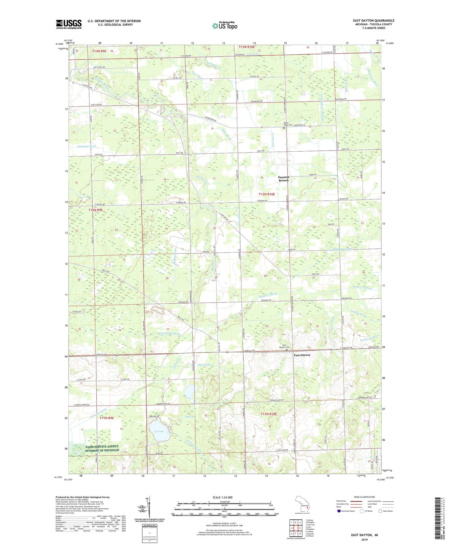
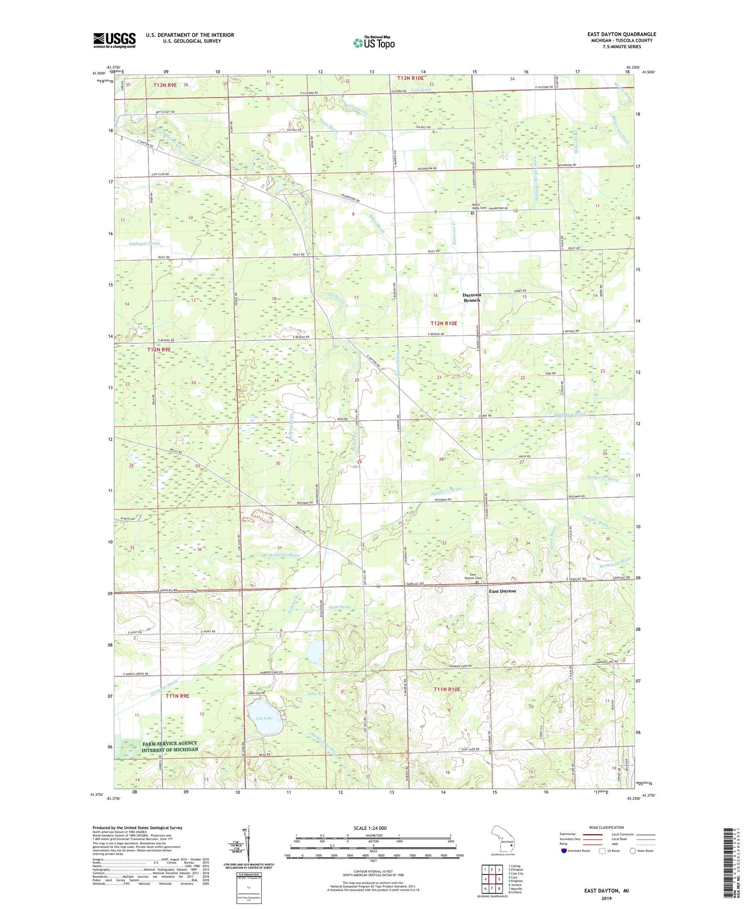
2019 topographic map quadrangle East Dayton in the state of Michigan. Scale: 1:24000. Based on the newly updated USGS 7.5' US Topo map series, this map is in the following counties: Tuscola. The map contains contour data, water features, and other items you are used to seeing on USGS maps, but also has updated roads and other features. This is the next generation of topographic maps. Printed on high-quality waterproof paper with UV fade-resistant inks.
Quads adjacent to this one:
West: Caro
Northwest: Colling
North: Ellington
Northeast: Cass City
East: Kingston
Southeast: Clifford
South: Mayville
Southwest: Juniata
Contains the following named places: Applegate Drain, Berry School, Bethel Church, Blackmere Drain, Bloch School, Butternut Drain, Cat Lake, Craw Drain, Dayton, Daytona Branch, Daytona Creek, Dykes Drain, East Dayton, East Dayton Cemetery, East Dayton Post Office, Fourtowns School, Frankfort School, Green Drain, Harmon Lake, Hollister Wright Drain, Hunt Drain, Jacoby Drain, Keene Stewart Drain, Lake Branch, McDonald Drain, McKnight Drain, Miller Drain, Morse Drain, North Wells Cemetery, Phelps Lake Drain, Riley Drain, Rolling Drain, Singleton Drain, South Drain, Sucker Creek Drain, Township of Wells, WIDL-FM (Caro)