MyTopo
Juniata Michigan US Topo Map
Couldn't load pickup availability
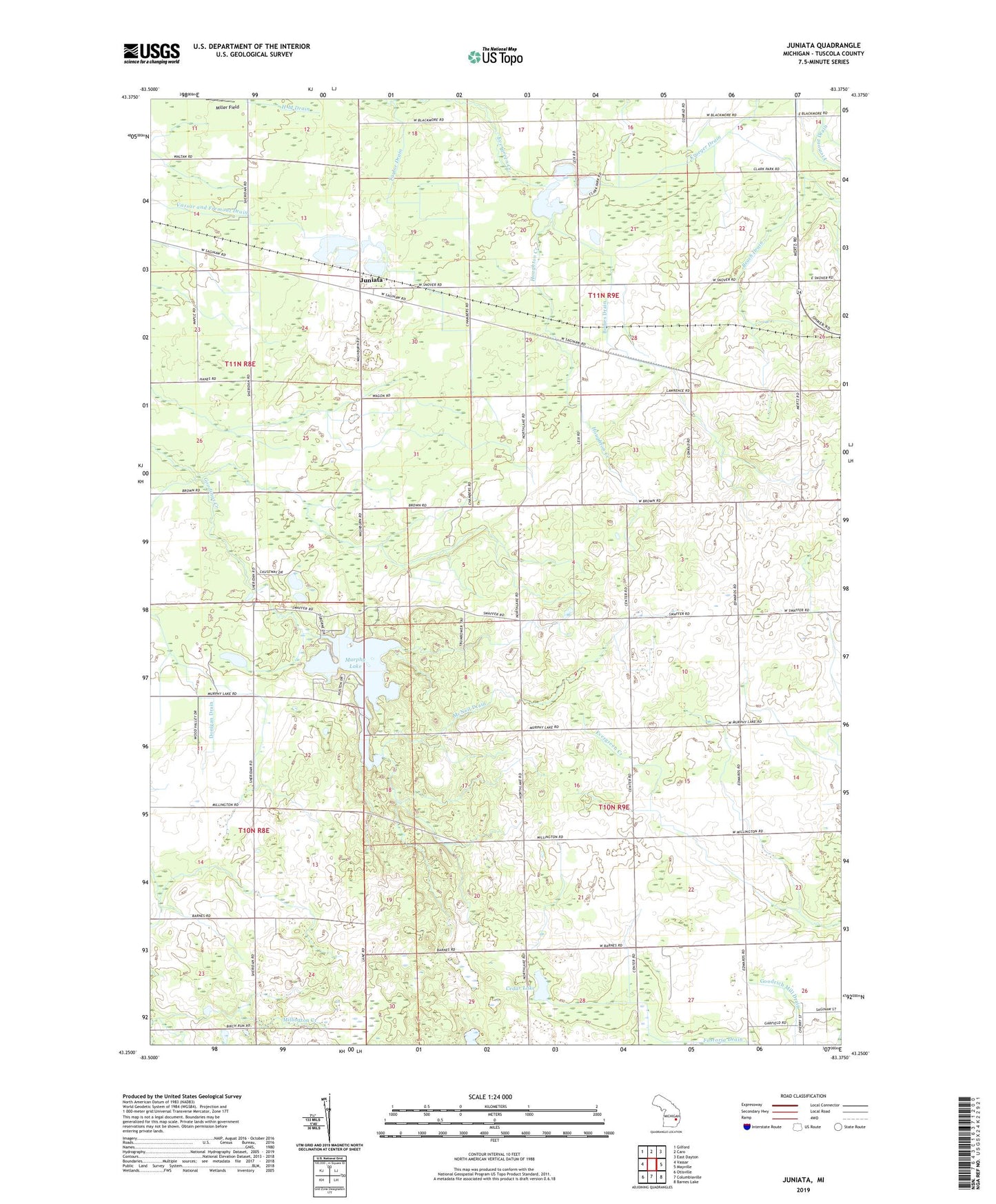
2023 topographic map quadrangle Juniata in the state of Michigan. Scale: 1:24000. Based on the newly updated USGS 7.5' US Topo map series, this map is in the following counties: Tuscola. The map contains contour data, water features, and other items you are used to seeing on USGS maps, but also has updated roads and other features. This is the next generation of topographic maps. Printed on high-quality waterproof paper with UV fade-resistant inks.
Quads adjacent to this one:
West: Vassar
Northwest: Gilford
North: Caro
Northeast: East Dayton
East: Mayville
Southeast: Barnes Lake
South: Columbiaville
Southwest: Otisville
This map covers the same area as the classic USGS quad with code o43083c4.
Contains the following named places: Beach Drain, Bodies Drain, Cass River Bible Church, Cedar Lake, Goodrich Mill Drain, Houghton Creek, Juniata, Juniata Baptist Church, Juniata Christian School, Juniata Post Office, Juniata Station, Krueger Drain, Letts Field Airport, Markell Post Office, McNeil Drain, Miller Field, Millet Learning Center, Murphy Lake, Murphy Lake State Game Area, Taylor Drain, Township of Fremont, Township of Watertown, Vassar and Fremont Drain, Watertown Center Bible Church, Watertown Center School, Willow Springs Golf and Country Club