MyTopo
Emerson Michigan US Topo Map
Couldn't load pickup availability
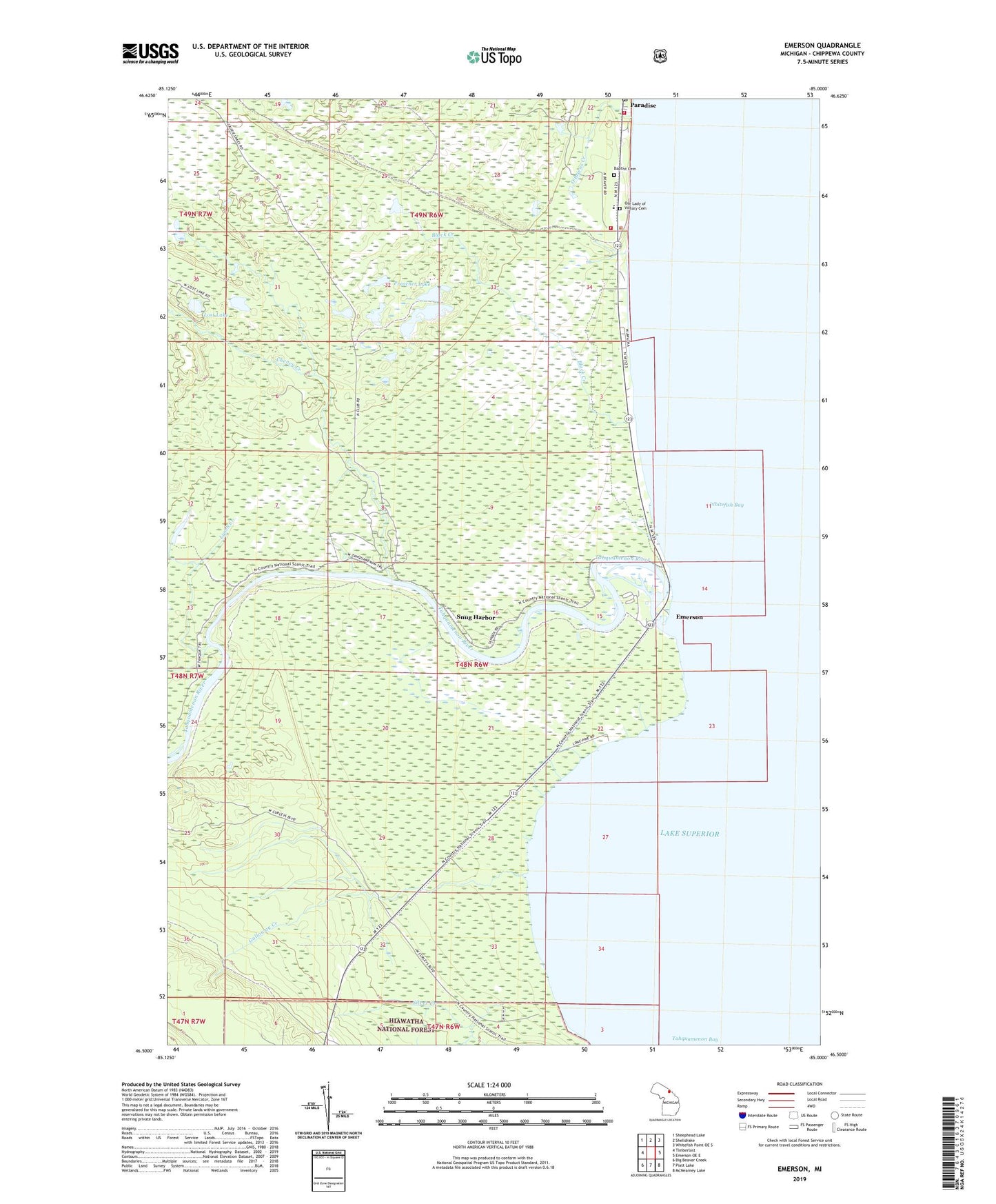
2019 topographic map quadrangle Emerson in the state of Michigan. Scale: 1:24000. Based on the newly updated USGS 7.5' US Topo map series, this map is in the following counties: Chippewa. The map contains contour data, water features, and other items you are used to seeing on USGS maps, but also has updated roads and other features. This is the next generation of topographic maps. Printed on high-quality waterproof paper with UV fade-resistant inks.
Quads adjacent to this one:
West: Timberlost
Northwest: Sheephead Lake
North: Shelldrake
Northeast: Whitefish Point OE S
East: Emerson OE E
Southeast: McNearney Lake
South: Piatt Lake
Southwest: Big Beaver Creek
Contains the following named places: Baptist Cemetery, Baptist Church, Black Creek, Cheney Creek, Chippewa Hunt Post, Clear Creek, Emerson, Emerson Historical Marker, Emerson Post Office, Galloway Creek, Hiawatha Hunt Club, Laurie Lakes, Lost Lake, Lynch Creek, O'Briens Creek, Our Lady of Victory Cemetery, Our Lady of Victory Church, Paradise Community Health Center, Paradise Post Office, Preacher Lake, Rivermouth Recreation Site, Silver Creek, Silver Creek Lodge, Snug Harbor, Soo Machine Club, Superior Gun Club, Tahquamenon Bay, Tahquamenon River, Township of Whitefish, United Methodist Church, Whitefish School, Whitefish Township Community Library, Whitefish Township Emergency Services, Whitefish Township Historical Marker