MyTopo
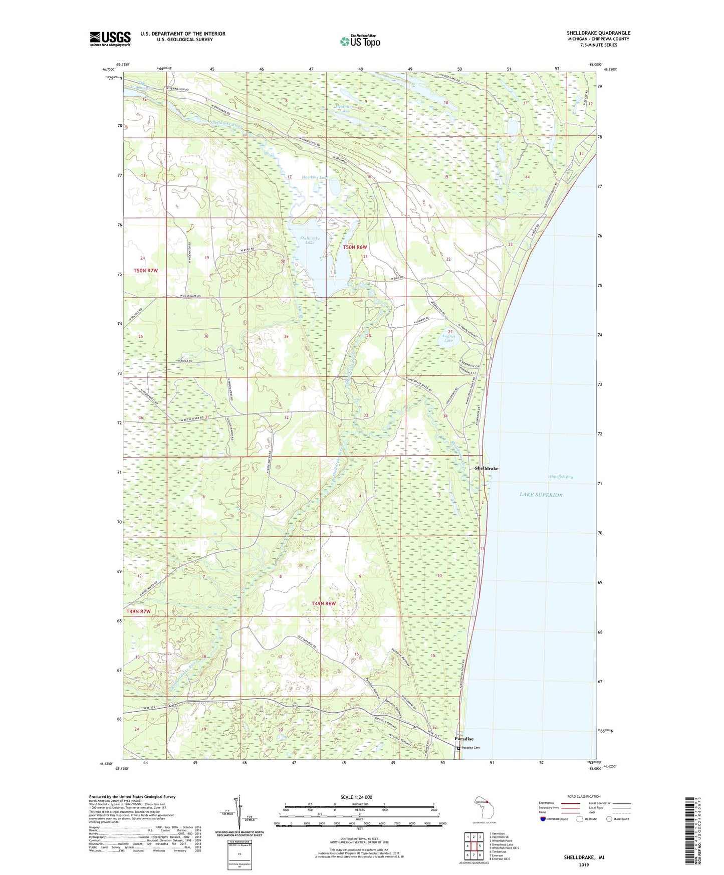
Shelldrake Michigan US Topo Map
Couldn't load pickup availability
2023 topographic map quadrangle Shelldrake in the state of Michigan. Scale: 1:24000. Based on the newly updated USGS 7.5' US Topo map series, this map is in the following counties: Chippewa. The map contains contour data, water features, and other items you are used to seeing on USGS maps, but also has updated roads and other features. This is the next generation of topographic maps. Printed on high-quality waterproof paper with UV fade-resistant inks.
Quads adjacent to this one:
West: Sheephead Lake
Northwest: Vermilion
North: Vermilion SE
Northeast: Whitefish Point
East: Whitefish Point OE S
Southeast: Emerson OE E
South: Emerson
Southwest: Timberlost
This map covers the same area as the classic USGS quad with code o46085f1.
Contains the following named places: Andrus Lake, Andrus Lake State Forest Campground, Dead Creek, Hawkins Lake, Marsh Lakes, McMullan Lakes, Paradise, Paradise Cemetery, Paradise Tower, Sawmill Creek Park, Shelldrake, Shelldrake Dam State Forest Campground, Shelldrake Historical Marker, Shelldrake Lake, Shelldrake Post Office, Shelldrake River, South Branch Shelldrake River, ZIP Code: 49768