MyTopo
Glenn Michigan US Topo Map
Couldn't load pickup availability
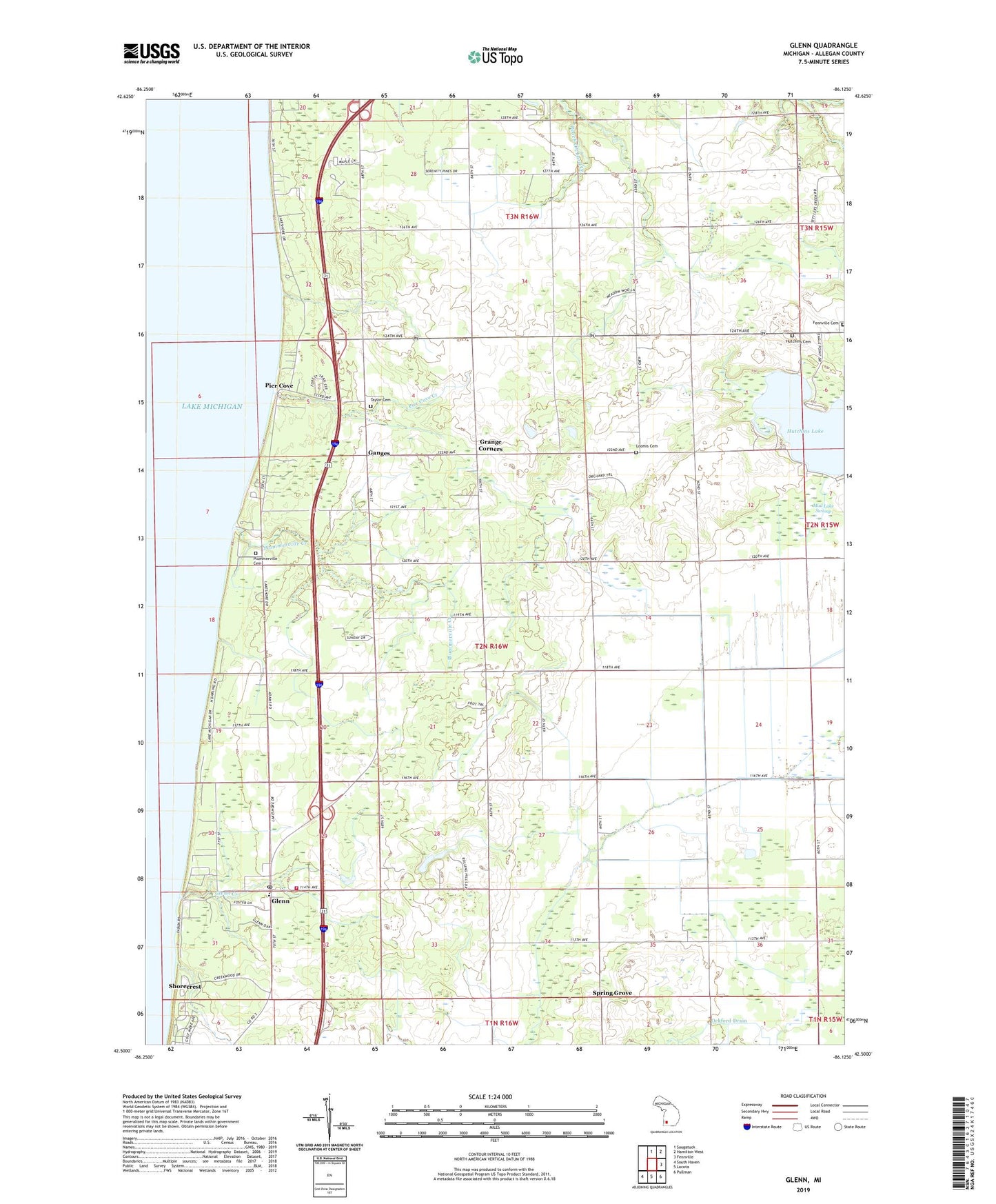
2019 topographic map quadrangle Glenn in the state of Michigan. Scale: 1:24000. Based on the newly updated USGS 7.5' US Topo map series, this map is in the following counties: Allegan. The map contains contour data, water features, and other items you are used to seeing on USGS maps, but also has updated roads and other features. This is the next generation of topographic maps. Printed on high-quality waterproof paper with UV fade-resistant inks.
Quads adjacent to this one:
North: Saugatuck
Northeast: Hamilton West
East: Fennville
Southeast: Pullman
South: Lacota
Southwest: South Haven
Contains the following named places: Allegan County Park, Barager School, Beaver Dam Drain, Belknap Post Office, Belknap School, Beverly Beach, Black River Drain, Campania Farm, Campit Camp Ground, Chase School, Darling School, Esther Post Office, Fennville Cemetery, Ganges, Ganges Church, Ganges Post Office, Ganges Township Fire Department, Ganges United Methodist Church, Glenn, Glenn Creek, Glenn Post Office, Glenn Rest Area, Glenn School, Glenn Shores, Glenn Shores Golf Club, Glenn United Methodist Church, Grange Corners, Hutchins Cemetery, Hutchins Lake, Lake Park Trailer Resort, Lake Shore Interfaith Community Church, Loomis Cemetery, Loomis School, Macks Landing School, Mud Lake Swamp, North State Road Drain, Orr School, Peach Belt School, Peachbelt Post Office, Pier Cove, Pier Cove Creek, Pier Cove Historical Marker, Plummerville Cemetery, Plummerville Creek, Reid School, Shorecrest, Spring Grove, Spring Grove Post Office, Stickel Landing Strip, Taylor Cemetery, Township of Ganges, West Side County Park, Wolf Drain