MyTopo
Fennville Michigan US Topo Map
Couldn't load pickup availability
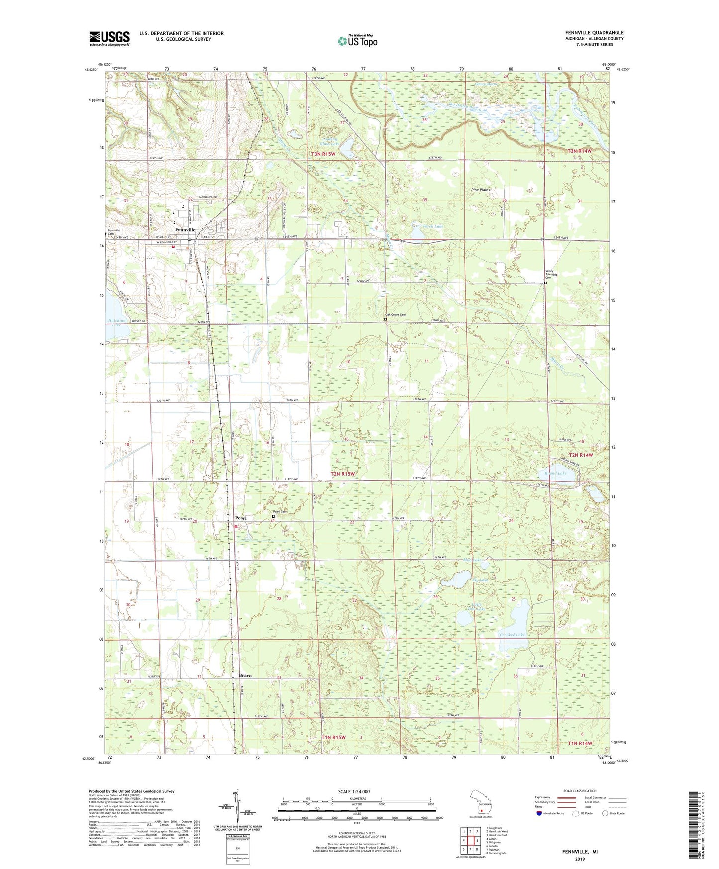
2023 topographic map quadrangle Fennville in the state of Michigan. Scale: 1:24000. Based on the newly updated USGS 7.5' US Topo map series, this map is in the following counties: Allegan. The map contains contour data, water features, and other items you are used to seeing on USGS maps, but also has updated roads and other features. This is the next generation of topographic maps. Printed on high-quality waterproof paper with UV fade-resistant inks.
Quads adjacent to this one:
West: Glenn
Northwest: Saugatuck
North: Hamilton West
Northeast: Hamilton East
East: Millgrove
Southeast: Bloomingdale
South: Pullman
Southwest: Lacota
This map covers the same area as the classic USGS quad with code o42086e1.
Contains the following named places: American Medical Response Fennville, Anderson School, Anna Michen Elementary School, Apostolica Church, Big Dailey Bayou, Big Goose Lake, Bravo, Bravo Christian Reformed Church, Bravo Post Office, City of Fennville, Clyde Township Fire Department, Crooked Lake, Discovery Elementary School, Dogwood Manor Mobile Home Park, Ely Lake, Ely Lake Campground, Fennville, Fennville Area Fire Department, Fennville Assembly of God Church, Fennville City Hall, Fennville District Library, Fennville Family Medicine, Fennville High School, Fennville Post Office, Fennville Station, Fennville United Methodist Church, General Church, Gidley School, Hemlock Point Gun Club, Horsemans Campground, Immanuel Reformed Church, Leverich Drain, Little Tom Lake, Looking Glass Lake, Mud Lake, Norwood School, Oak Grove Cemetery, Open Door Worship Center, Ottawa Gun Club, Ottawa Marsh, Pearl, Pearl Cemetery, Pearl Post Office, Pearl Station, Perch Lake, Pine Plains, Round Lake, Seventh Day Adventist Church, Township of Clyde, Tracy School, Utter Drain, Valley Township Cemetery, Walker School, Whitmeyer School, ZIP Code: 49408