
MyTopo
Gobles East Michigan US Topo Map
Couldn't load pickup availability
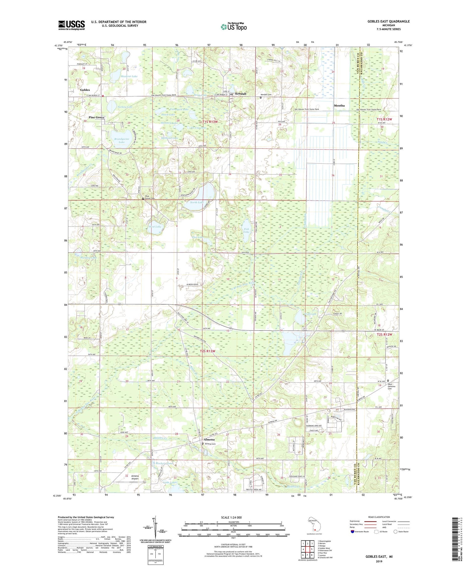
2019 topographic map quadrangle Gobles East in the state of Michigan. Scale: 1:24000. Based on the newly updated USGS 7.5' US Topo map series, this map is in the following counties: Van Buren, Kalamazoo. The map contains contour data, water features, and other items you are used to seeing on USGS maps, but also has updated roads and other features. This is the next generation of topographic maps. Printed on high-quality waterproof paper with UV fade-resistant inks.
Quads adjacent to this one:
West: Gobles West
Northwest: Bloomingdale
North: Merson
Northeast: Otsego
East: Kalamazoo SW
Southeast: Schoolcraft NW
South: Lawton
Southwest: Paw Paw
Contains the following named places: Almena, Almena Airport, Almena Cemetery, Almena Ponds State Fish Hatchery, Almena Post Office, Almena School, Almena United Methodist Church, Blockers Pond, Brandywine Lake, Brown School, Bullhead Lake, Calvary Baptist Church, Campbell Creek, Cobbtown School, Coloma Emergency Medical Services Medical Transport Station 4, East Lake, Fish Lake, Gobles - Pine Grove Fire Department, Hawk Lake, Hayden Creek, Hemlock Lake, Heritage Glen Golf Club, Johnstown School, Kendall, Kendall Cemetery, Kendall Post Office, Kendall Station, Kendall United Methodist Church, Lime Lake, Markley Lake, Mentha, Mentha Post Office, Metha Station, Moore School, Muskrat Lake, North Lake, Old Pine Grove School, Palmer School, Pine Grove, Pine Grove Cemetery, Pine Grove Mills Post Office, Pine Grove Mills Station, Ridgeview Golf Course, Ritter Creek, Sand Creek, Shady Brook Mobile Home Park, Slack School, Solomon School, Story Lake, Tamarack Lake, Tin Cup Lake, Todd Drain, Township of Almena, Turkey Lake, West Lake, West Oshtemo Cemetery, West Oshtemo Church, Widner Landing Strip, Wolf Lake, Wolf Lake Fish Hatchery, ZIP Code: 49055


