MyTopo
Lawrence Michigan US Topo Map
Couldn't load pickup availability
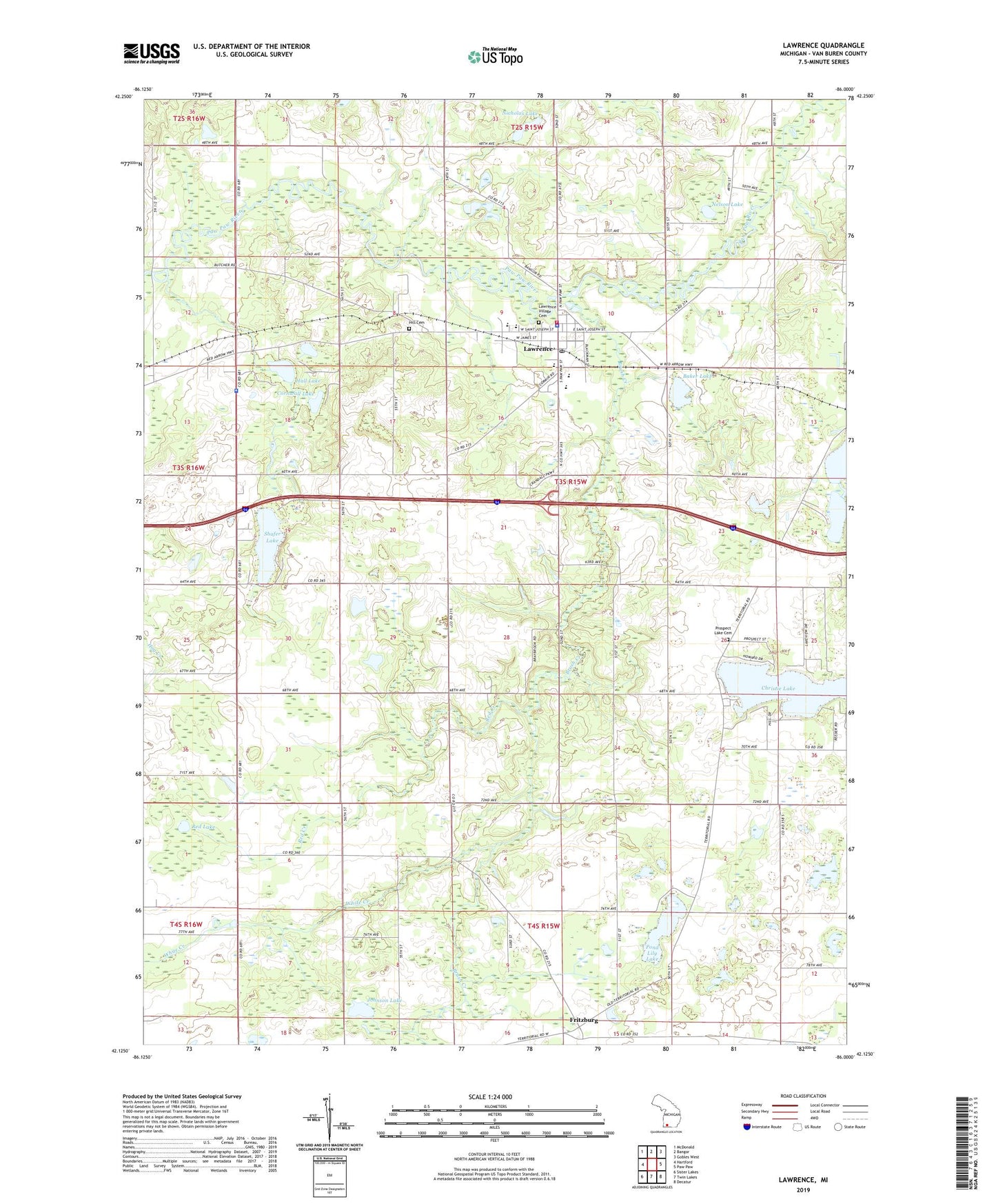
2019 topographic map quadrangle Lawrence in the state of Michigan. Scale: 1:24000. Based on the newly updated USGS 7.5' US Topo map series, this map is in the following counties: Van Buren. The map contains contour data, water features, and other items you are used to seeing on USGS maps, but also has updated roads and other features. This is the next generation of topographic maps. Printed on high-quality waterproof paper with UV fade-resistant inks.
Quads adjacent to this one:
West: Hartford
Northwest: McDonald
North: Bangor
Northeast: Gobles West
East: Paw Paw
Southeast: Decatur
South: Twin Lakes
Southwest: Sister Lakes
Contains the following named places: Allen School, Baker Lake, Barnes School, Braybrooks School, Brush Creek, Christie Lake, Cornwall Lake, Corwin School, First Congregational Church, Fritzburg, Full Gospel Church, Hall Lake, Hill Cemetery, Hyde School, Johnson Lake, Kingdom Hall of Jehovah's Witnesses, Lamphere School, Lawrence, Lawrence Bible Baptist Church, Lawrence Elementary School, Lawrence High School, Lawrence Library, Lawrence Mobile Home Park, Lawrence Police Department, Lawrence Post Office, Lawrence Station, Lawrence Township Emergency Services, Lawrence United Methodist Church, Lawrence Village Cemetery, Lee School, Monroe School, Nelson Lake, Nesbit School, Nicholas Lake, Pond Lily Lake, Prospect Lake Cemetery, Prospect Lake Post Office, Red Creek, Red Lake, School Number 3, Shafer Lake, Shafer School, Township of Lawrence, Van Buren County Poorhouse Historical Marker, Van Buren Skills Center, Village of Lawrence, White Creek, ZIP Code: 49064