MyTopo
Twin Lakes Michigan US Topo Map
Couldn't load pickup availability
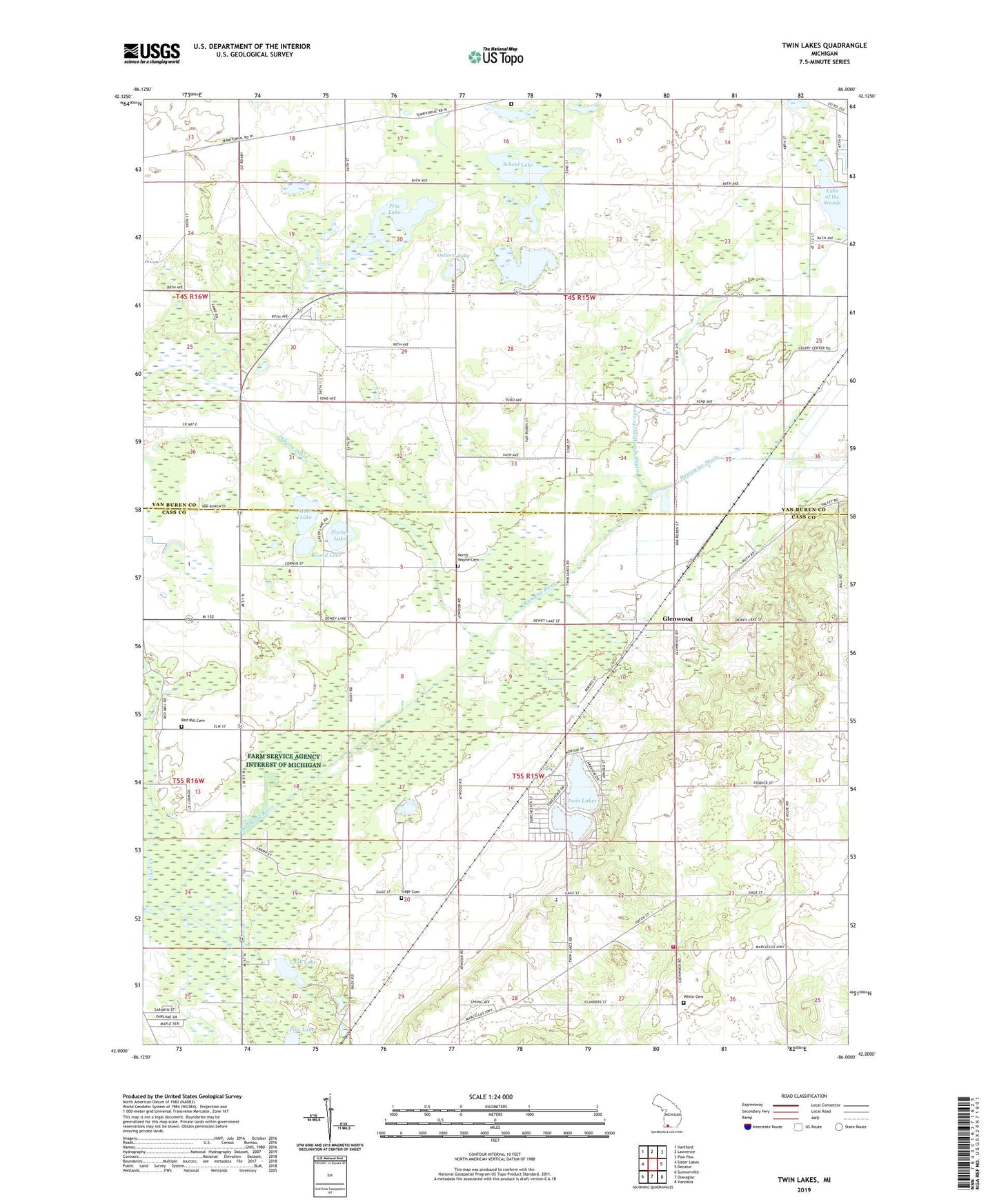
2023 topographic map quadrangle Twin Lakes in the state of Michigan. Scale: 1:24000. Based on the newly updated USGS 7.5' US Topo map series, this map is in the following counties: Cass, Van Buren. The map contains contour data, water features, and other items you are used to seeing on USGS maps, but also has updated roads and other features. This is the next generation of topographic maps. Printed on high-quality waterproof paper with UV fade-resistant inks.
Quads adjacent to this one:
West: Sister Lakes
Northwest: Hartford
North: Lawrence
Northeast: Paw Paw
East: Decatur
Southeast: Vandalia
South: Dowagiac
Southwest: Sumnerville
This map covers the same area as the classic USGS quad with code o42086a1.
Contains the following named places: Bell School, Celery Center School, Code School, Cook Lake, Field School, Five Mile Corners, Five Mile Drive In Theater, Four Winds Fellowship Church, Gage Cemetery, Gage School, Geer Lake, Glenwood, Glenwood Post Office, Glenwood Seventh Day Adventist Church, Glenwood Station, Glenwood Union Seventh Day Adventist School, Hamilton Cemetery, Hamilton Chapel, Hamilton Grange Hall Historical Marker, Hayden School, Kirkwood School, Knickerbocker Lake, Lake of the Woods Drain, North Wayne Cemetery, North Wayne Mennonite Church, North Wayne School, Oak Shores Campground, Old Past Church of Christ, Old Path Church of God in Christ, Osborn Drain, Osborn Lake, Phelps Mobile Home Park, Pine Lake, Pitcher Lake, Pitcher Lake Campground, Red Mill Cemetery, Round Lake, Rowlee School, School Lake, Timber Trails RV Park, Township of Hamilton, Township of Wayne, Twin Lakes, Wayne Township Fire Department, White Cemetery, White School