MyTopo
Marine City Michigan US Topo Map
Couldn't load pickup availability
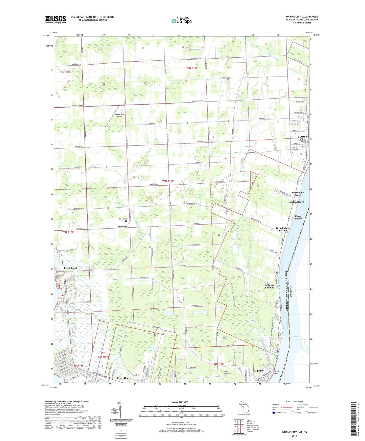
2019 topographic map quadrangle Marine City in the state of Michigan. Scale: 1:24000. Based on the newly updated USGS 7.5' US Topo map series, this map is in the following counties: St. Clair. The map contains contour data, water features, and other items you are used to seeing on USGS maps, but also has updated roads and other features. This is the next generation of topographic maps. Printed on high-quality waterproof paper with UV fade-resistant inks.
Quads adjacent to this one:
West: New Baltimore
Northwest: Adair
North: Rattle Run
East: Marine City OE E
South: Algonac
Southwest: Saint Clair Flats
Contains the following named places: Algonac High School, Algonac State Park, Algonac-Clay Library, Avalon Beach, Beaubien Creek, Beaverdam Drain, Belle River Elementary School, Broadbridge Station, Cherry Beach, China Belle Oil and Gas Field, China South Gas Field, City of Marine City, Colony Tower Historical Marker, Copeland Corner, Cottrellville Oil and Gas Field, Gleaners Hall, Holy Cross Cemetery, Locust Point, Long Land Farm Landing Strip, Maple Grove Cemetery, Marine City Airport, Marine City Drain, Marine City Fire Department, Marine City High School, Marine City Library, Marine City Oil Field, Marine City Police Department, Marine City South Oil and Gas Field, Martindale Beach, Pearl Beach, Pearl Beach Census Designated Place, Pearl Beach Post Office, Perch Point, Roberts Landing, Roberts Landing Post Office, Saint Catherine Cemetery, Saint Clair River Historical Marker, Salt Dock Light, Smith Cemetery, Starrville Post Office, Starville, Starville Church, Swartout Creek, Tag-A-Long Trailer Court, Township of Cottrellville, Ward-Cottrell High School, Willow Point Light, WSMA-AM (Marine City), ZIP Codes: 48001, 48039