MyTopo
Saint Clair Flats Michigan US Topo Map
Couldn't load pickup availability
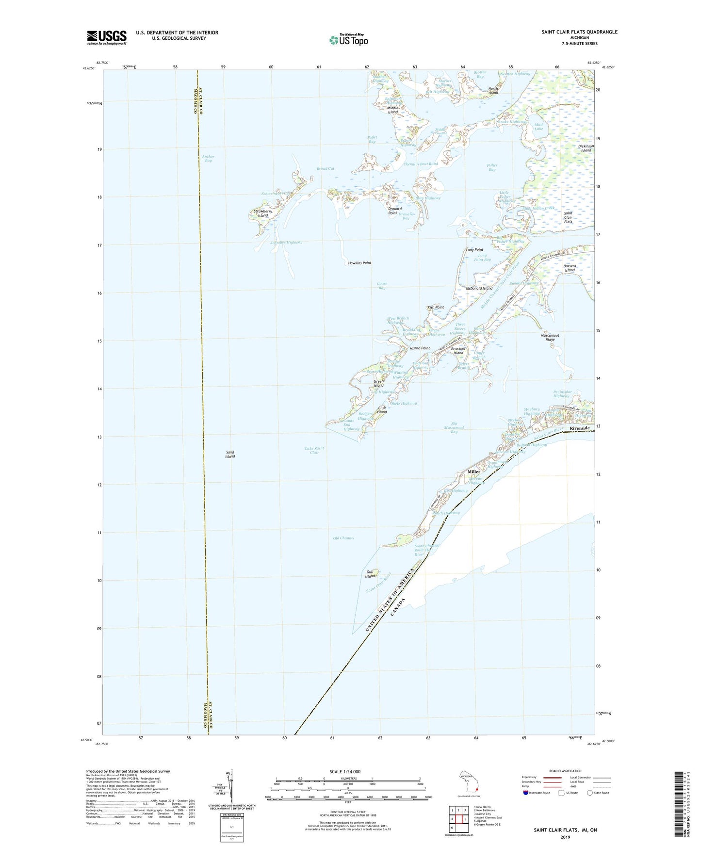
2023 topographic map quadrangle Saint Clair Flats in the state of Michigan. Scale: 1:24000. Based on the newly updated USGS 7.5' US Topo map series, this map is in the following counties: St. Clair, Macomb. The map contains contour data, water features, and other items you are used to seeing on USGS maps, but also has updated roads and other features. This is the next generation of topographic maps. Printed on high-quality waterproof paper with UV fade-resistant inks.
Quads adjacent to this one:
West: Mount Clemens East
Northwest: New Haven
North: New Baltimore
Northeast: Marine City
East: Algonac
Southwest: Grosse Pointe OE E
This map covers the same area as the classic USGS quad with code o42082e6.
Contains the following named places: Baltimore Highway, Bedford Highway, Belt Highway, Big Fisher Highway, Big Muscamoot Bay, Blind Indian Creek, Blue Hill Pond, Broad Cut, Broad Cut Highway, Bruckner Island, Bryant Highway, Canoe Highway, Chenal A Bout Rond, Chene Highway, Clinton River Boat Club, Club Island, Craig Highway, Dandron Highway, Dickinson Island, Doty Highway, Drouard Bay, Drouard Point, Fish Point, Fisher Bay, Goose Bay, Gooseneck Pond, Green Island, Grummond Highway, Gull Island, Hawkins Point, Hurlburt Highway, Ives Highway, Johnnies Highway, Joy Highway, Lands End Highway, Little Fisher Highway, Little Lake, Little Muscamoot Bay, Log Highway, Long Point, Long Point Bay, Lower Branch, Maybury Highway, McDonald Island, Mervue Highway, Middle Channel Saint Clair River, Middle Ground, Middle Island, Miller, Moross Highway, Mud Lake, Mudhen Highway, Munro Point, Muscamoot Ridge, North Island, Obetz Highway, Old Channel, Old Channel Light, Peninsular Highway, Pollet Bay, Riverside, Roach Highway, Rodgers Highway, Saint Clair Flats, Saint Clair Flats Canal, Saint Clair River, Sand Island, Savage Highway, Schweinkart Cut, Scotten Bay, Scotten Highway, Sears Highway, Slocum Highway, Snake Highway, Snooks Highway, South Channel Saint Clair River, Strawberry Island, Strelow Highway, Three Rivers Highway, Township of Clay, Upper Branch, West Branch Highway, Wide Cut Highway, Winding Highway