MyTopo
McDonald Michigan US Topo Map
Couldn't load pickup availability
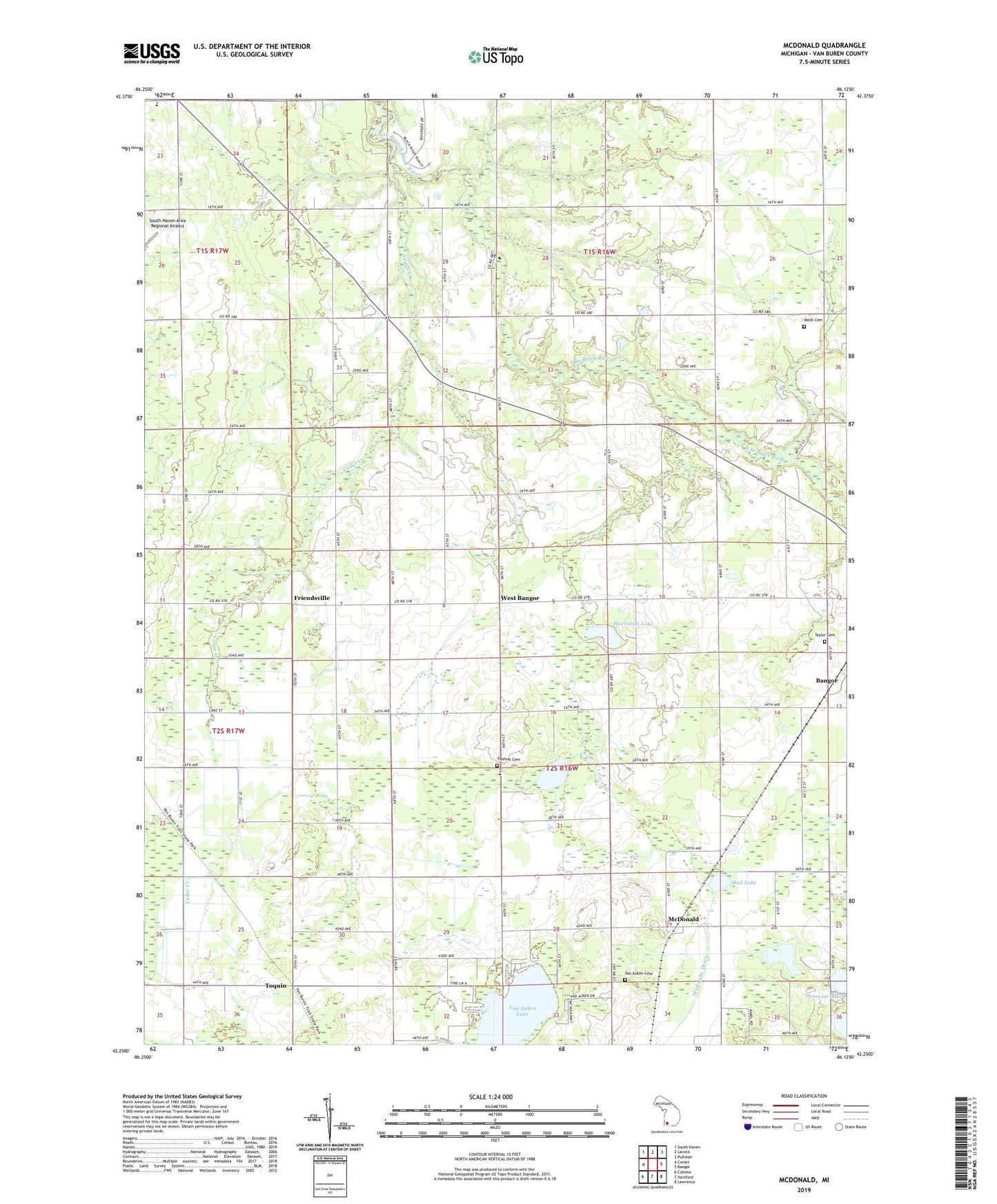
2019 topographic map quadrangle McDonald in the state of Michigan. Scale: 1:24000. Based on the newly updated USGS 7.5' US Topo map series, this map is in the following counties: Van Buren. The map contains contour data, water features, and other items you are used to seeing on USGS maps, but also has updated roads and other features. This is the next generation of topographic maps. Printed on high-quality waterproof paper with UV fade-resistant inks.
Quads adjacent to this one:
West: Covert
Northwest: South Haven
North: Lacota
Northeast: Pullman
East: Bangor
Southeast: Lawrence
South: Hartford
Southwest: Coloma
Contains the following named places: Bangor Center School, Cedar Creek, Circle Y Ranch Bible Camp, Coloma Emergency Medical Services Medical Transport Station 2, Donovan Lake, Duck Lake, Friendsville, German Church, Hawley School, His Place Cathedral of Faith, Hooker Post Office, Jericho Corners, Jericho School, Johnstown School, Lafler School, Maple Grove Bible Church, Maple Grove Elementary School, Maple Grove School, McDonald, McDonald Post Office, McDonald Station, Merriman Lake, Monk Cemetery, Mud Lake, Mud Lake Drain, North Mill School, School Section Lake, Seventh Day Adventist Church, Taylor Cemetery, Thomas Cemetery, Toquin, Toquin Post Office, Toquin Station, Township of Bangor, Van Auken Cemetery, Van Auken Lake, Van Auken School, Webster School, West Bangor, West Brick School, West Gate School, Wood School