MyTopo
Covert Michigan US Topo Map
Couldn't load pickup availability
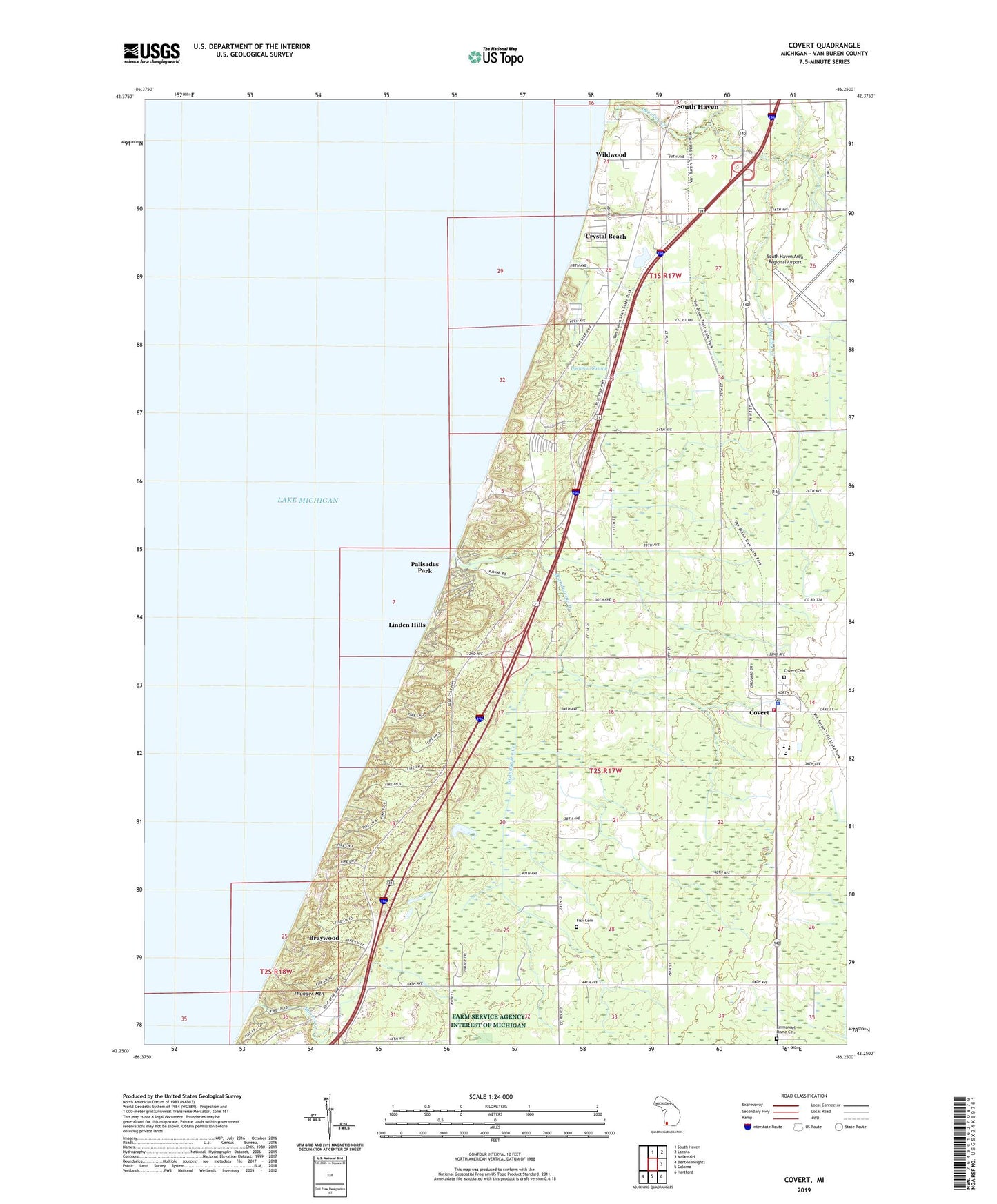
2023 topographic map quadrangle Covert in the state of Michigan. Scale: 1:24000. Based on the newly updated USGS 7.5' US Topo map series, this map is in the following counties: Van Buren. The map contains contour data, water features, and other items you are used to seeing on USGS maps, but also has updated roads and other features. This is the next generation of topographic maps. Printed on high-quality waterproof paper with UV fade-resistant inks.
Quads adjacent to this one:
North: South Haven
Northeast: Lacota
East: McDonald
Southeast: Hartford
South: Coloma
Southwest: Benton Heights
This map covers the same area as the classic USGS quad with code o42086c3.
Contains the following named places: Blue Star Church, Brandywine Creek, Braywood, Camp Na Wa Kwa, Charter Township of South Haven, Consumers Power Company Heliport, Covert, Covert Branch Library, Covert Cemetery, Covert Community Church, Covert High School, Covert Historical Museum, Covert Library Historical Marker, Covert Medical Center, Covert Post Office, Covert Station, Covert Township Fire Department, Covert Township Park, Covert Township Police Department, Covert/South Haven KOA Campground, Crystal Beach, Deerlick Creek, Deerlick School, Dune Lake Campground, Dyckman Swamp, Emanuel Home, Emmanuel Home Cemetery, First Baptist Church, First Spiritual Church of God, Fish Cemetery, Fish Corners, Fish School, Gospel Tabernacle Baptist Church, Law School, Linden Hills, Mitchell Brothers Mobile Home Park, Mud Lake, Packard Gospel Center, Packard Post Office, Palisades Park, Pallisades Park Post Office, Rogers Creek, Roosevelt Hills, Seventh-Day Adventist Church, South Haven Area Regional Airport, Thunder Mountain, Township of Covert, Trinity Church, Van Buren County, Van Buren State Park, WCSY-FM (South Haven), Wildwood, ZIP Code: 49043