
MyTopo
Onondaga Michigan US Topo Map
Couldn't load pickup availability
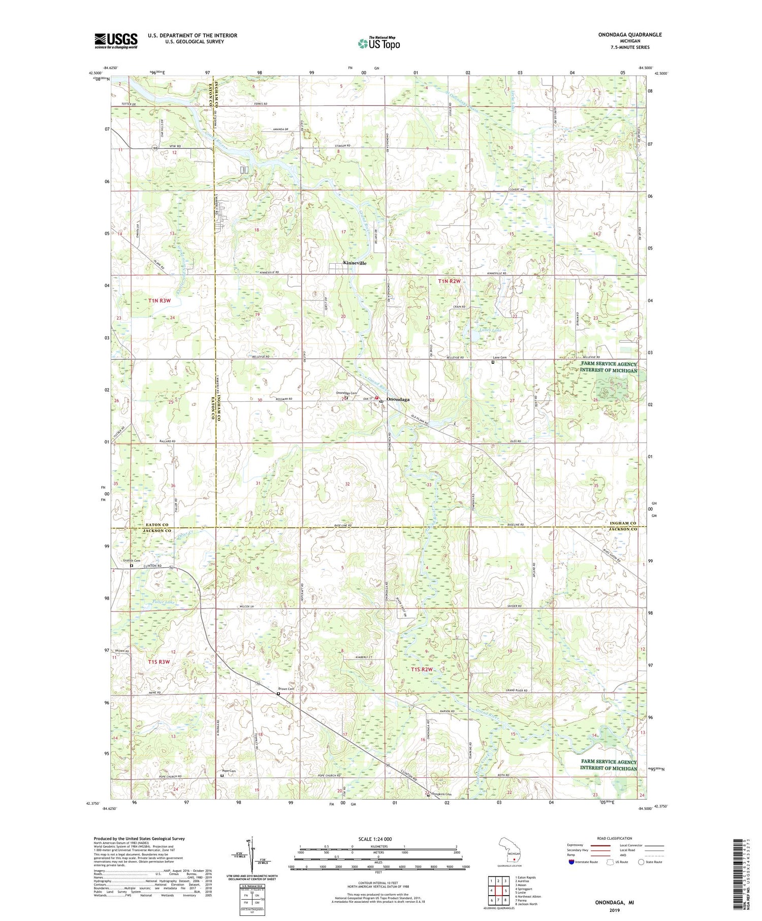
2019 topographic map quadrangle Onondaga in the state of Michigan. Scale: 1:24000. Based on the newly updated USGS 7.5' US Topo map series, this map is in the following counties: Ingham, Jackson, Eaton. The map contains contour data, water features, and other items you are used to seeing on USGS maps, but also has updated roads and other features. This is the next generation of topographic maps. Printed on high-quality waterproof paper with UV fade-resistant inks.
Quads adjacent to this one:
West: Springport
Northwest: Eaton Rapids
North: Aurelius
Northeast: Mason
East: Leslie
Southeast: Jackson North
South: Parma
Southwest: Northeast Albion
Contains the following named places: Annis School, Arland Post Office, Arland School, Arland Station, Baldwin Park, Brown Cemetery, Butts School, Childs Bible Church, Childs School, Country Manor Mobile Home Park, Fuller Lake, Goold School, Griffith Cemetery, Griffith School, Hayden School, Highfields Community Boys Camp, Jameson Farm Historical Marker, Kettler and Norris Drain, Kinneville, Lane Cemetery, Lanes Lake, North Onondaga Drain, Onondaga, Onondaga Cemetery, Onondaga Community United Church, Onondaga Dragway, Onondaga Fire Department, Onondaga Post Office, Onondaga Station, Onondaga Township Fire Department, Ottercreek Post Office, Pope Cemetery, Pope Church, Sandstone Creek, School Number 6, Sherd School, Tompkins Cemetery, Tompkins School, Township of Onondaga, Township of Tompkins, VFW National Home, Walcott School, Williams Airport, WILX-TV (Onondaga), Winfield Post Office, Winfield School, WJXQ-FM (Jackson), WLAJ-TV (Lansing), ZIP Code: 49264


