MyTopo
Parkers Corners Michigan US Topo Map
Couldn't load pickup availability
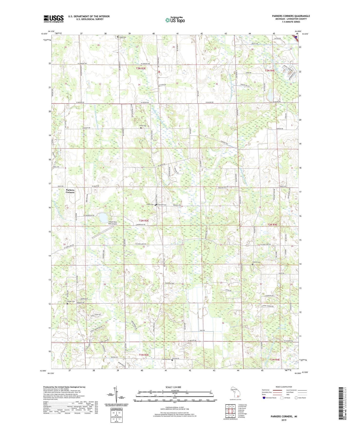
2019 topographic map quadrangle Parkers Corners in the state of Michigan. Scale: 1:24000. Based on the newly updated USGS 7.5' US Topo map series, this map is in the following counties: Livingston. The map contains contour data, water features, and other items you are used to seeing on USGS maps, but also has updated roads and other features. This is the next generation of topographic maps. Printed on high-quality waterproof paper with UV fade-resistant inks.
Quads adjacent to this one:
West: Millville
Northwest: Webberville
North: Fowlerville
Northeast: Oak Grove
East: Howell
Southeast: Pinckney
South: Gregory
Southwest: Stockbridge
Contains the following named places: Burkhart Ridge Mobile Home Park, Cloud 9 Airport, Eisele Cemetery, Fowlerville Fire Department Damon Substation, Greene Cemetery, Handy Iosco Drain Number 1, Harford Cemetery, Iosco Drain Number Three, Iosco Drain Number Two, Iosco Post Office, Kuhn Lake, Lamoreaux Lake, Loree Cemetery, Marion Iosco Drain, Marion Post Office, Mason Road Church, Mud Lake, Munsell Cemetery, Paige Cemetery, Parkers Corners, Parkers Corners School, Township of Iosco, Trinity Church, Wasson Lake, Wright Cemetery