MyTopo
Oak Grove Michigan US Topo Map
Couldn't load pickup availability
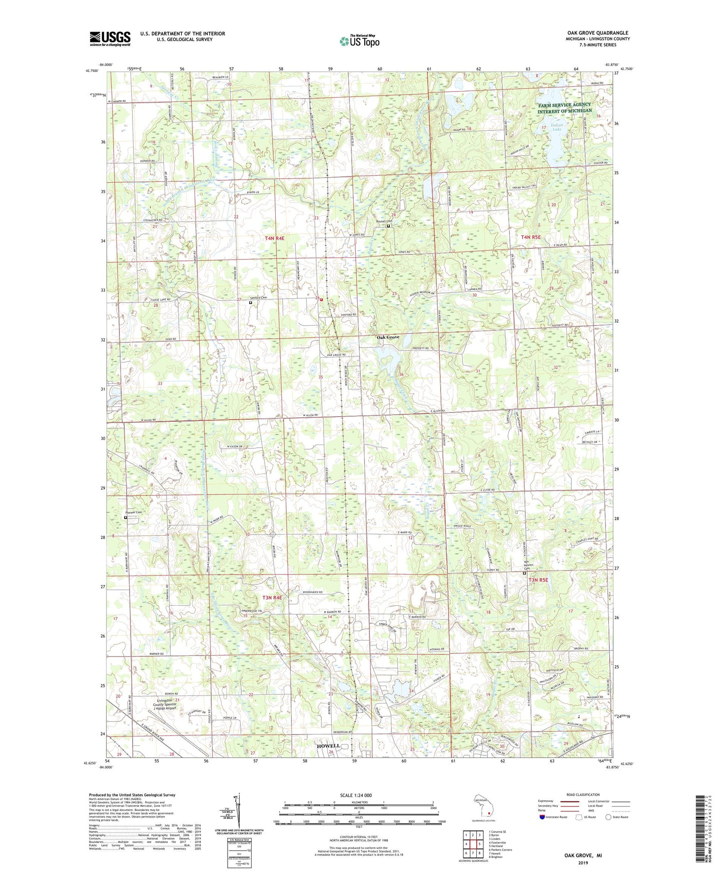
2023 topographic map quadrangle Oak Grove in the state of Michigan. Scale: 1:24000. Based on the newly updated USGS 7.5' US Topo map series, this map is in the following counties: Livingston. The map contains contour data, water features, and other items you are used to seeing on USGS maps, but also has updated roads and other features. This is the next generation of topographic maps. Printed on high-quality waterproof paper with UV fade-resistant inks.
Quads adjacent to this one:
West: Fowlerville
Northwest: Corunna SE
North: Byron
Northeast: Linden
East: Hartland
Southeast: Brighton
South: Howell
Southwest: Parkers Corners
This map covers the same area as the classic USGS quad with code o42083f8.
Contains the following named places: Bogue Creek, Boutell Cemetery, Cohoctah Church, Dama Farms Golf Course, Frank J Hecox House Historical Marker, Hidden Lake, Hidden Springs Church, Howell Area Fire Department Station 24, Hunters Ridge Golf Course, Hutchings Elementary School, Immanuel Lutheran Church, Indian Lake, Livingston County Emergency Medical Services, Livingston County Spencer J Hardy Airport, Marr Church, Oak Grove, Oak Grove Post Office, Oak Grove State Game Area, Oak Grove Station, Oak Grove United Methodist Church, Pioneer Cemetery, Saint Augustine Church and Cemetery Historical Marker, Sanford Cemetery, Sprague Creek, Taylor's Beach Campground, Township of Cohoctah, Township of Howell, Van Keuren Cemetery, WHMI-FM (Howell), ZIP Code: 48855