MyTopo
Pleasant Lake Michigan US Topo Map
Couldn't load pickup availability
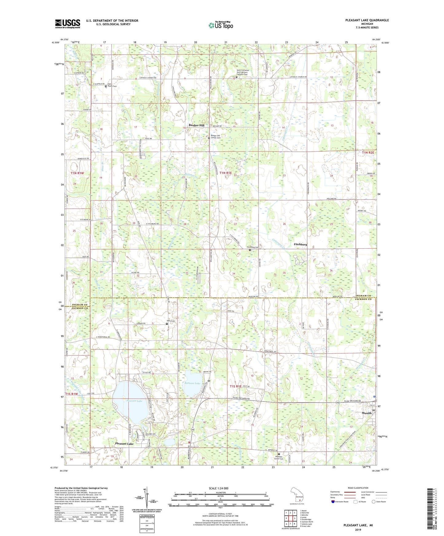
2019 topographic map quadrangle Pleasant Lake in the state of Michigan. Scale: 1:24000. Based on the newly updated USGS 7.5' US Topo map series, this map is in the following counties: Ingham, Jackson. The map contains contour data, water features, and other items you are used to seeing on USGS maps, but also has updated roads and other features. This is the next generation of topographic maps. Printed on high-quality waterproof paper with UV fade-resistant inks.
Quads adjacent to this one:
West: Leslie
Northwest: Mason
North: Dansville
Northeast: Millville
East: Stockbridge
Southeast: Grass Lake
South: Gilletts Lake
Southwest: Jackson North
Contains the following named places: Batteese Lake, Bunker Hill, Bunker Hill Center Cemetery, Bunker Hill Seventh Day Church, Bunkerhill Post Office, Cahaogan Creek, Christ Episcopal Church, Church of Jesus Christ, Felt Plains Cemetery, Felt Plains Church, Felt's Post Office, Fitchburg, Fitchburg Cemetery, Fitchburg Post Office, Hankerd Hills Golf Course, Henrietta Post Office, Henrietta School, Henrietta Township Fire Department, Holy Bible Church of God, Jackson District Library-Pleasant Lake Branch, Katz Elementary School, Mud Lake, Munith, Munith Post Office, Munith Station, Munith United Methodist Church, Nims Cemetery, P J Family Campground, Pleasant Grove Cemetery, Pleasant Lake, Pleasant Lake Campground, Pleasant Lake Church, Pleasant Lake Mobile Home Court, Pleasant Lake Post Office, Saint Cornelius and Cyprian's Catholic Cemetery, Saints Cornelius and Cyprian Church, Saints Cornelius and Cyprian School, Township of Bunker Hill, Township of Henrietta, Trinity Pentecostal Church, Waterloo Township Police Department, Wheel Inn Campground, Wilderness Park, ZIP Code: 49272