MyTopo
Gilletts Lake Michigan US Topo Map
Couldn't load pickup availability
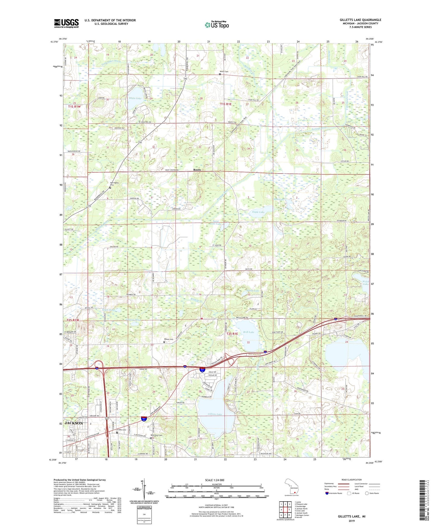
2023 topographic map quadrangle Gilletts Lake in the state of Michigan. Scale: 1:24000. Based on the newly updated USGS 7.5' US Topo map series, this map is in the following counties: Jackson. The map contains contour data, water features, and other items you are used to seeing on USGS maps, but also has updated roads and other features. This is the next generation of topographic maps. Printed on high-quality waterproof paper with UV fade-resistant inks.
Quads adjacent to this one:
West: Jackson North
Northwest: Leslie
North: Pleasant Lake
Northeast: Stockbridge
East: Grass Lake
Southeast: Norvell
South: Michigan Center
Southwest: Jackson South
This map covers the same area as the classic USGS quad with code o42084c3.
Contains the following named places: Apostolic Church, Batteese Creek, Blackman Township Department of Public Safety Station 2, Brill Lake, Clement School, Cradit Cemetery, Eagle Lake, East Jackson High School, East Jackson Junior High School, East Jackson Memorial School, Eastgate Shopping Center, Gilletts Lake, Goose Lake, Green Pasture Camp, Greenwood Acres Campground, Harmony Church, Harrington Cemetery, Henrietta Station, Hideaway Campgrounds, Holiday Manor Park, Jackson District Library-East Branch, Kinch Cemetery, Kingdom Hall, Kryst Pond, Leoni Township Fire Department Station 2, Malay Lake, Maxon Cemetery, McArthur Cemetery, Mud Lake, O'Leary Pond, Orchard Creek, Pine Hollow Golf Club, Robinson School, Roots, Roots Post Office, Roots Station, Saint Demetrius Church, Saint John Lake, Sherman Lake, Smith Lake, Sparrow Hawk Golf Course, Sun Valley Mobile Home Estates, Sycamore Church, Township of Leoni, Twin Lakes, Twin Lakes Drain, White Lake, Wildcat Creek, ZIP Code: 49259