MyTopo
Randville Michigan US Topo Map
Couldn't load pickup availability
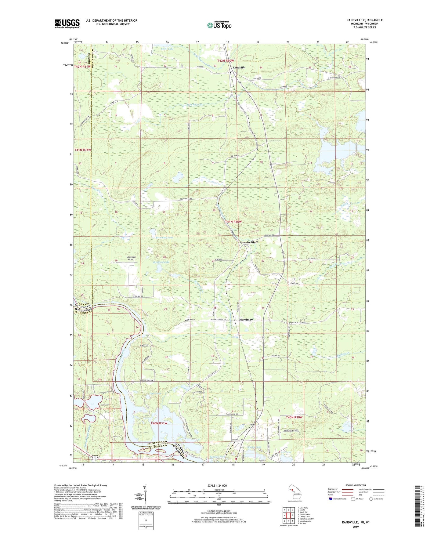
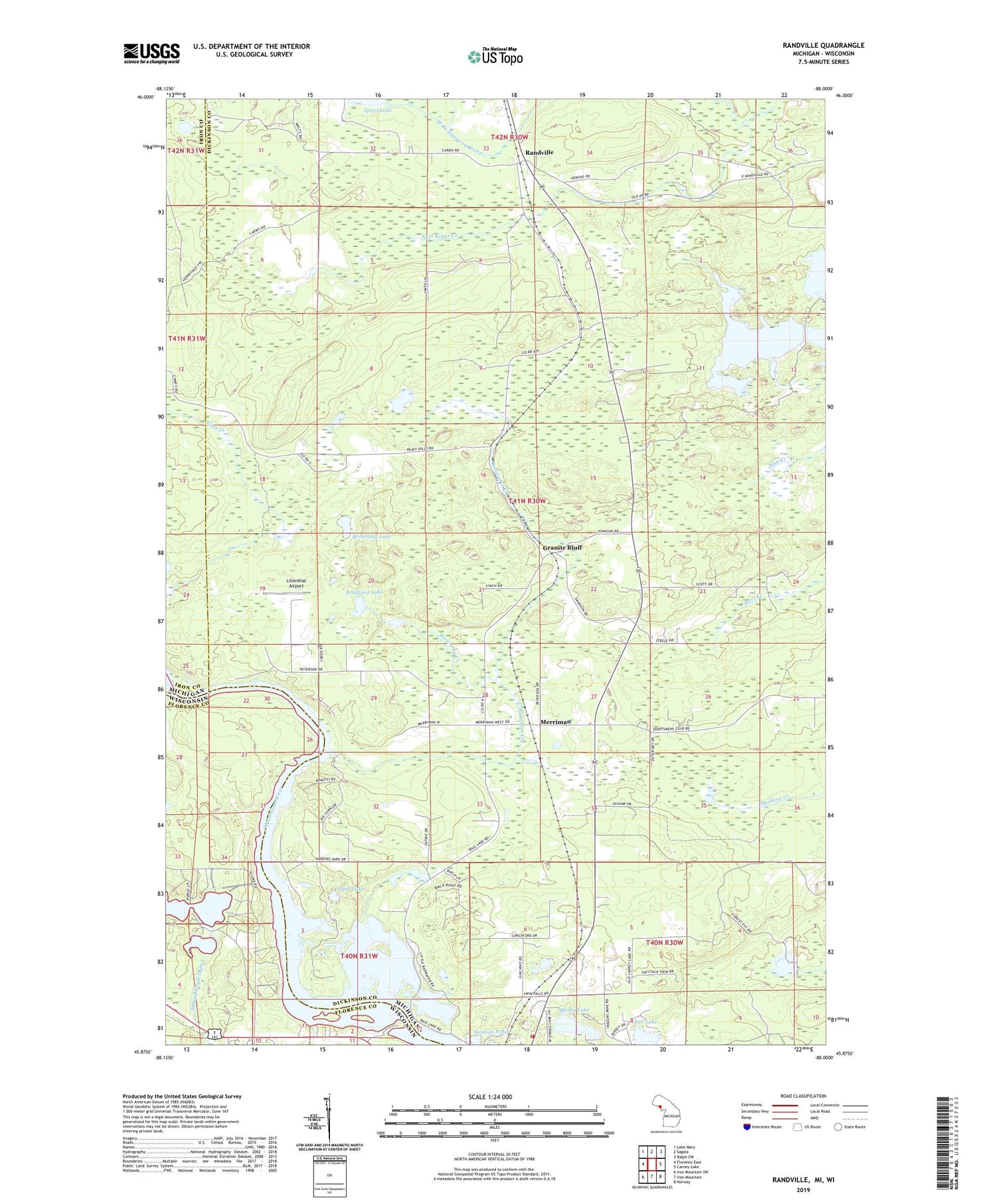
2019 topographic map quadrangle Randville in the states of Michigan, Wisconsin. Scale: 1:24000. Based on the newly updated USGS 7.5' US Topo map series, this map is in the following counties: Dickinson, Florence, Iron. The map contains contour data, water features, and other items you are used to seeing on USGS maps, but also has updated roads and other features. This is the next generation of topographic maps. Printed on high-quality waterproof paper with UV fade-resistant inks.
Quads adjacent to this one:
West: Florence East
Northwest: Lake Mary
North: Sagola
Northeast: Ralph SW
East: Carney Lake
Southeast: Norway
South: Iron Mountain
Southwest: Iron Mountain SW
Contains the following named places: Badwater Creek, Badwater Lake, Bradford Lake, Breitung Township Fire Department Station 3, Browning Creek, Browning Lake, Deer Lake, Dyer Lake, East Lake, Gestner Branch, Granite Bluff, Granite Bluff Post Office, Granite Bluff Station, Harding Lake, Lilienthal Airport, Little Badwater Lake, Merriman, Merriman Station, Randville, Randville Bible Church, Randville Post Office, Randville Station, Sonnies Pond, South Lake, Spring Lake, Summer Breeze Campgrounds, Tom Kings Creek, Vagabond Cabins