MyTopo
Iron Mountain SW Wisconsin US Topo Map
Couldn't load pickup availability
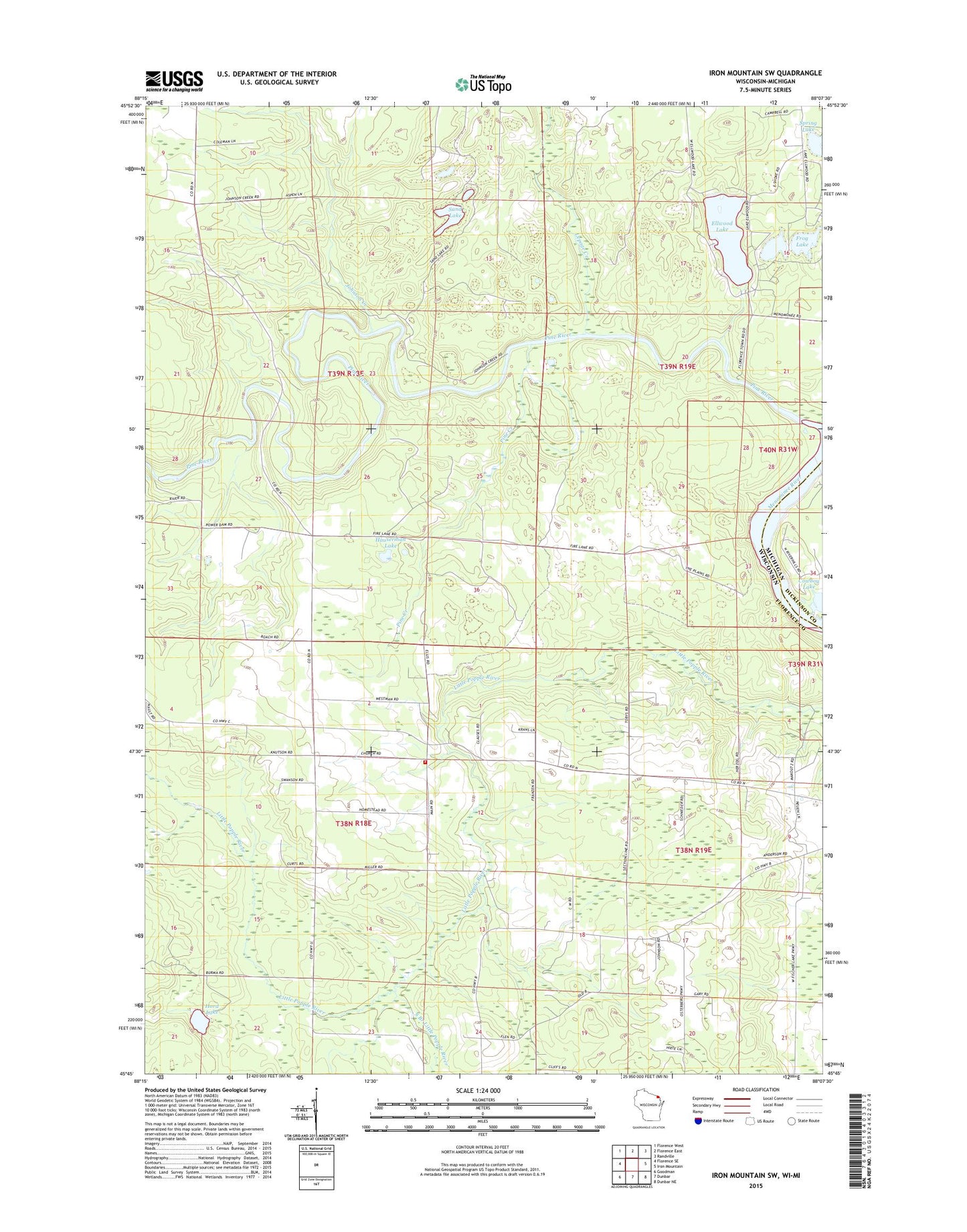
2022 topographic map quadrangle Iron Mountain SW in the state of Wisconsin. Scale: 1:24000. Based on the newly updated USGS 7.5' US Topo map series, this map is in the following counties: Florence, Dickinson. The map contains contour data, water features, and other items you are used to seeing on USGS maps, but also has updated roads and other features. This is the next generation of topographic maps. Printed on high-quality waterproof paper with UV fade-resistant inks.
Quads adjacent to this one:
West: Florence SE
Northwest: Florence West
North: Florence East
Northeast: Randville
East: Iron Mountain
Southeast: Dunbar NE
South: Dunbar
Southwest: Goodman
This map covers the same area as the classic USGS quad with code o45088g2.
Contains the following named places: 0.82 Reservoir, Aurora Free Church, Bass Lake, Brown School, Ellwood Lake, Fairview School, Frog Lake, Hauserman Lake, Henry Ford Dam, Homestead, Homestead Volunteer Fire Department, Hord Lake, Johnson Creek, Kingsford Flowage, Lepage Creek, Lindow G7265 Dam, Pine Creek, Pine River Power Plant, Roach School, Sand Lake, South Branch Little Popple River, Spread Eagle Barrens State Natural Area, Spring Lake, Town of Aurora, Town of Commonwealth