MyTopo
Redman Michigan US Topo Map
Couldn't load pickup availability
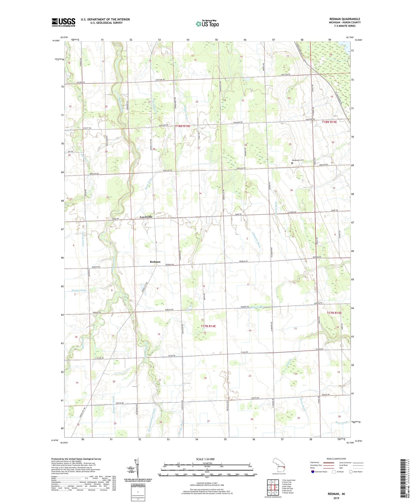
2019 topographic map quadrangle Redman in the state of Michigan. Scale: 1:24000. Based on the newly updated USGS 7.5' US Topo map series, this map is in the following counties: Huron. The map contains contour data, water features, and other items you are used to seeing on USGS maps, but also has updated roads and other features. This is the next generation of topographic maps. Printed on high-quality waterproof paper with UV fade-resistant inks.
Quads adjacent to this one:
West: Kinde East
Northwest: Port Austin East
North: Huron City
East: Port Hope
Southeast: Harbor Beach
South: Bad Axe SE
Southwest: Bad Axe East
Contains the following named places: Bloomfield Sigel Drain, East Branch Willow Creek, Haggerty Drain, Hartz Drain, Hood Drain, Huron County, Iseler Drain, Kranz Drain, Lawitzke Drain, Lewisville, Marquardt Cemetery, Red School, Redman, Redman Post Office, Schave Drain, Schmaltz Drain, Stewart Drain, Tinsey Drain, Township of Bloomfield, Township of Huron, Wismer Drain, ZIP Code: 48468