MyTopo
Kinde East Michigan US Topo Map
Couldn't load pickup availability
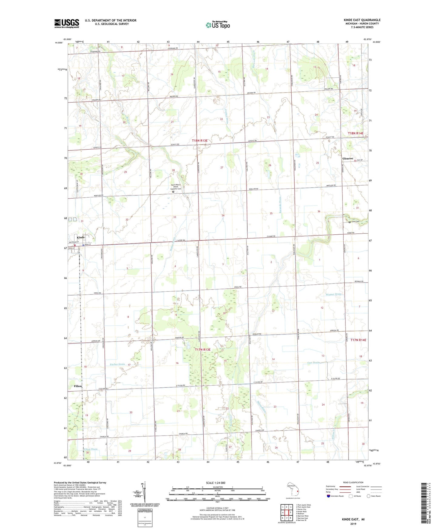
2023 topographic map quadrangle Kinde East in the state of Michigan. Scale: 1:24000. Based on the newly updated USGS 7.5' US Topo map series, this map is in the following counties: Huron. The map contains contour data, water features, and other items you are used to seeing on USGS maps, but also has updated roads and other features. This is the next generation of topographic maps. Printed on high-quality waterproof paper with UV fade-resistant inks.
Quads adjacent to this one:
West: Kinde West
Northwest: Port Austin West
North: Port Austin East
Northeast: Huron City
East: Redman
Southeast: Bad Axe SE
South: Bad Axe East
Southwest: Bad Axe West
This map covers the same area as the classic USGS quad with code o43082h8.
Contains the following named places: Carr Drain, Church School, Cramp Drain, Filion Drain, Filion Station, Glencoe, Glencoe Post Office, Kinde, Kinde Area Fire Department, Kinde Police Department, Kinde Post Office, Kinde Presbyterian Church, Kinde Station, Kinde Village Hall, Lincoln Drain, Marsa Drain, Pitcher Drain, Rice Drain, Saint Edward's Church, Saint Mary of Czestochowa Roman Catholic Church Historical Marker, Saint Marys Church, Saint Mary's Polish Catholic Cemetery, Saint Peters Lutheran Church, Township of Dwight, Township of Lincoln, Varney Post Office, Varney Station, Village of Kinde, Weber Drain, WFMM-FM (Harbor Beach), Zion Saint Peters Lutheran Cemetery, ZIP Codes: 48432, 48445