MyTopo
Silver Lake Basin Michigan US Topo Map
Couldn't load pickup availability
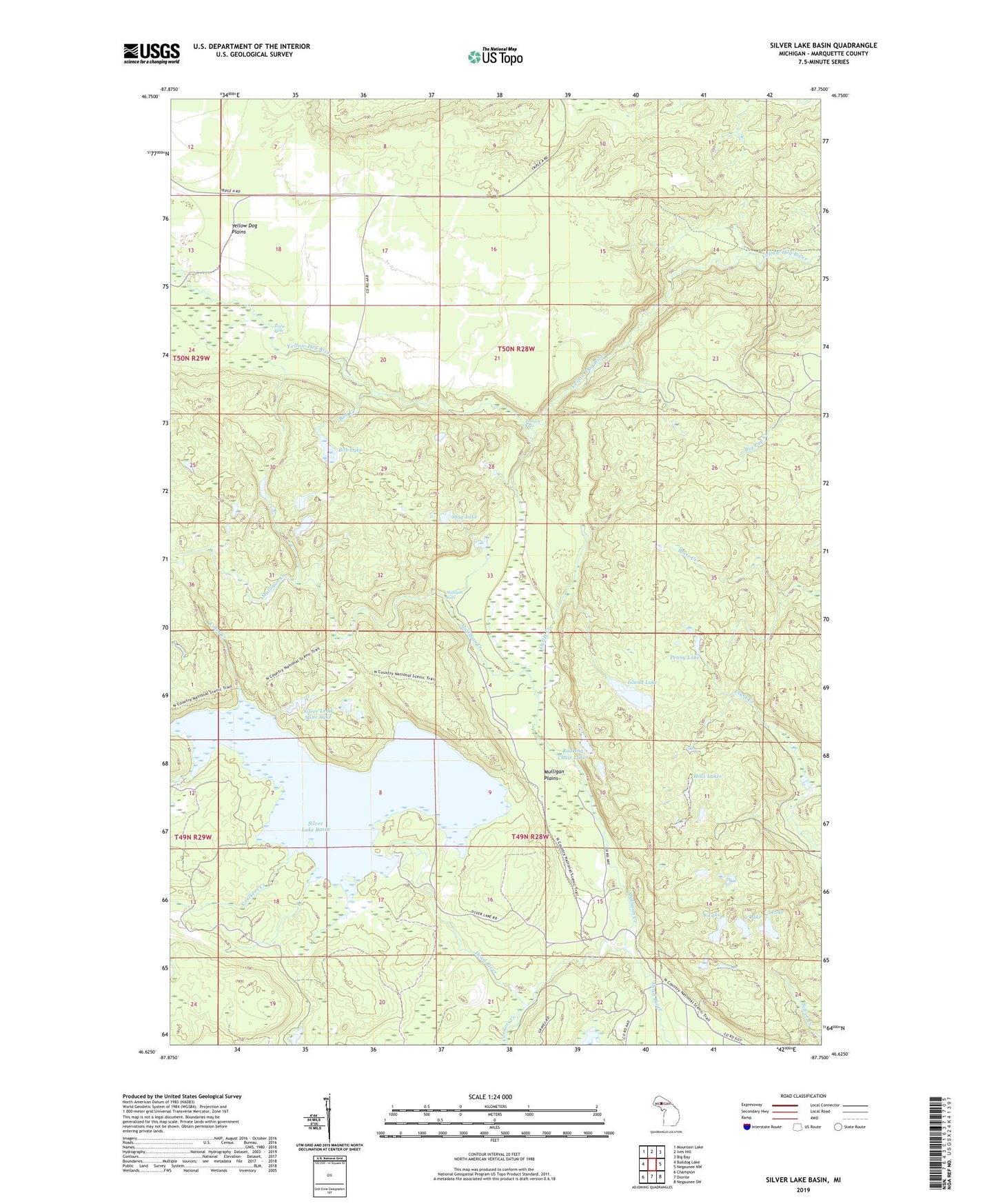
2019 topographic map quadrangle Silver Lake Basin in the state of Michigan. Scale: 1:24000. Based on the newly updated USGS 7.5' US Topo map series, this map is in the following counties: Marquette. The map contains contour data, water features, and other items you are used to seeing on USGS maps, but also has updated roads and other features. This is the next generation of topographic maps. Printed on high-quality waterproof paper with UV fade-resistant inks.
Quads adjacent to this one:
West: Bulldog Lake
Northwest: Mountain Lake
North: Ives Hill
Northeast: Big Bay
East: Negaunee NW
Southeast: Negaunee SW
South: Diorite
Southwest: Champion
Contains the following named places: 2 Lake, 3 Lake, 8 Lake, Bob Creek, Bob Lake, Coles Creek, Connors Creek, Gander Lake, Hills Lakes, Island Lake, Mulligan Creek, Mulligan Falls, Mulligan Plains, Outlet Creek, Penny Lake, Pinnacle Falls, Rocking Chair Lakes, Silver Lake Basin, Silver Lead Mine Lake, Stag Lake, Township of Champion, Voelkers Creek, Wylie Falls, Yellow Dog Plains