MyTopo
Mountain Lake Michigan US Topo Map
Couldn't load pickup availability
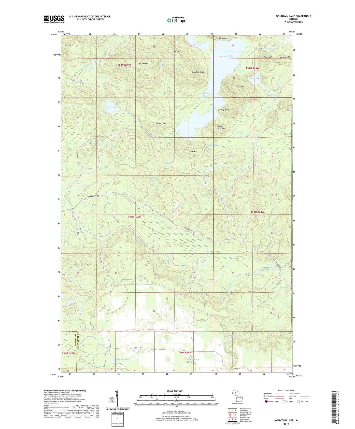
2023 topographic map quadrangle Mountain Lake in the state of Michigan. Scale: 1:24000. Based on the newly updated USGS 7.5' US Topo map series, this map is in the following counties: Marquette, Baraga. The map contains contour data, water features, and other items you are used to seeing on USGS maps, but also has updated roads and other features. This is the next generation of topographic maps. Printed on high-quality waterproof paper with UV fade-resistant inks.
Quads adjacent to this one:
West: McComb Corner
Northwest: Glovers Corner
North: Howe Lake
Northeast: Huron Mountain
East: Ives Hill
Southeast: Silver Lake Basin
South: Bulldog Lake
Southwest: Summit Lake
This map covers the same area as the classic USGS quad with code o46087g8.
Contains the following named places: Anderson Pond, Bentley Ponds, Burnt Mountain, Canyon Lake, Cedar Creek, Cliff Lake, Cliff River, Dudley Point, Forty Foot Falls, Lake Ann, Lumberman Bay, Mink Run, Mount Benison, Mount Homer, Mount Ida, Mountain Lake, Mountain Stream, Mummy Mountain, Tokiahok Head, Trout Lake, Trout Mountain, Turkey Neck Falls, Turner Point, West Branch Salmon Trout River