
MyTopo
Smith Lake Michigan US Topo Map
Couldn't load pickup availability
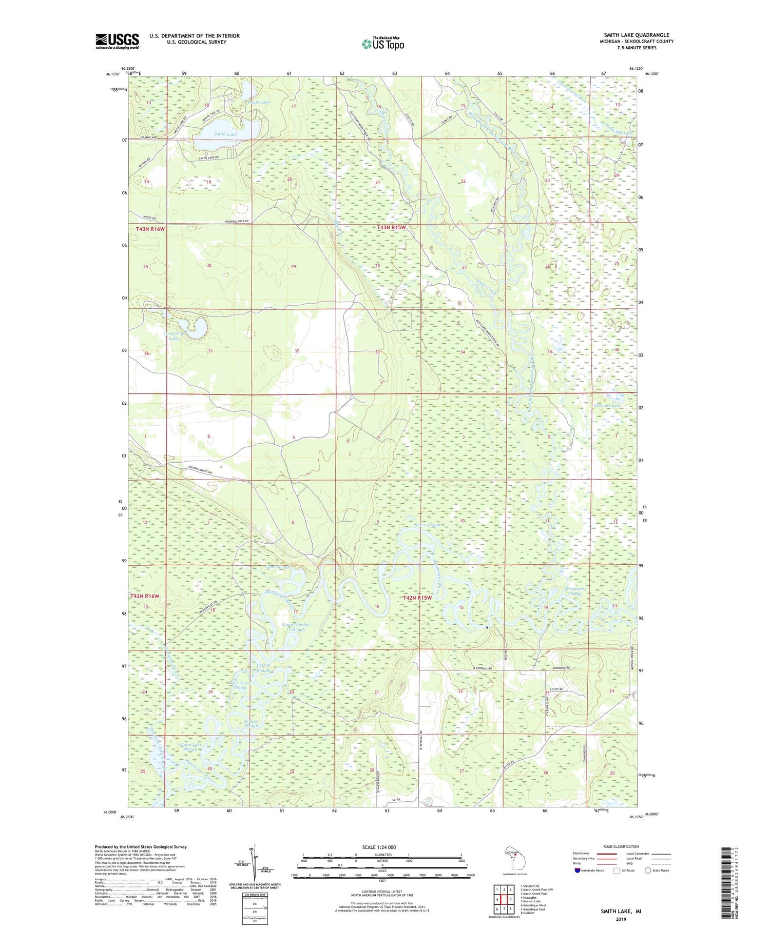
2019 topographic map quadrangle Smith Lake in the state of Michigan. Scale: 1:24000. Based on the newly updated USGS 7.5' US Topo map series, this map is in the following counties: Schoolcraft. The map contains contour data, water features, and other items you are used to seeing on USGS maps, but also has updated roads and other features. This is the next generation of topographic maps. Printed on high-quality waterproof paper with UV fade-resistant inks.
Quads adjacent to this one:
West: Hiawatha
Northwest: Steuben NE
North: Marsh Creek Pool NW
Northeast: Marsh Creek Pool
East: Merwin Lake
Southeast: Gulliver
South: Manistique East
Southwest: Manistique West
Contains the following named places: Bear Town Slough, Brace Creek, Brassel Slough, Camp Nine Lakes, Camp Number 11 Slough, Catfish Slough, Cedar Grove Mennonite Church, Clear Slough, Clemons Lake, Davis Slough, Doyle Lake, High Rollways Truck Trail, Island Lake Slough, Klegstads Slough, Schoolcraft County, Smith Lake, Sturgeon Hole Creek, Sturgeon Hole Slough, Stutts Creek, West Branch Manistique River


