MyTopo
Stevensville Michigan US Topo Map
Couldn't load pickup availability
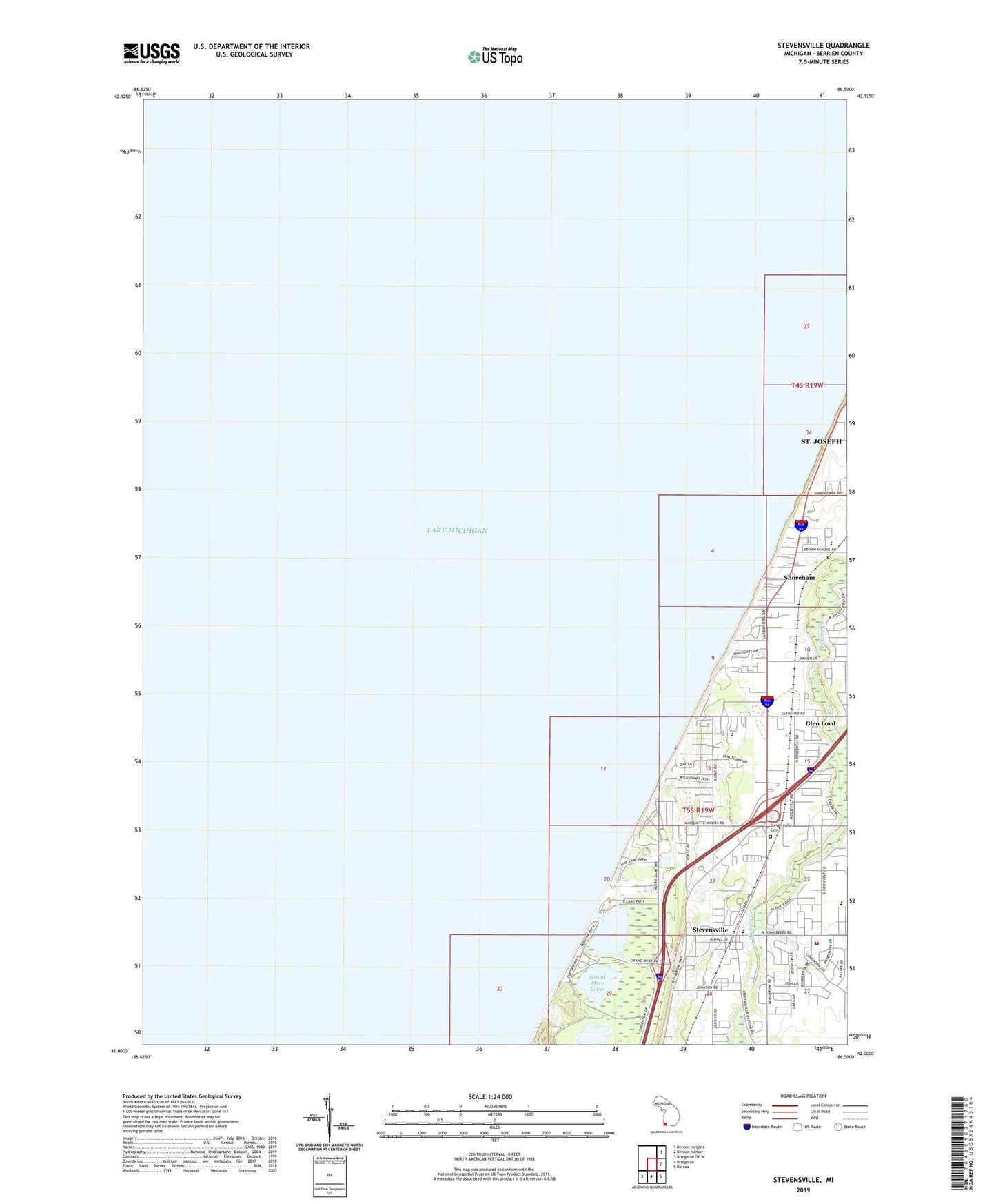
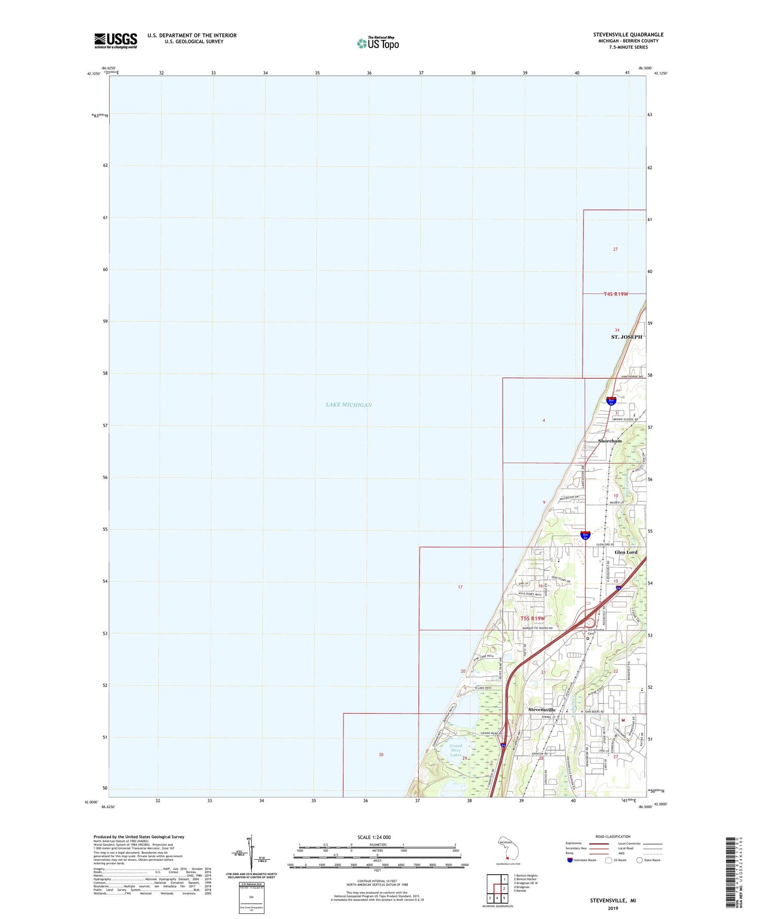
2019 topographic map quadrangle Stevensville in the state of Michigan. Scale: 1:24000. Based on the newly updated USGS 7.5' US Topo map series, this map is in the following counties: Berrien. The map contains contour data, water features, and other items you are used to seeing on USGS maps, but also has updated roads and other features. This is the next generation of topographic maps. Printed on high-quality waterproof paper with UV fade-resistant inks.
Quads adjacent to this one:
Northeast: Benton Heights
East: Benton Harbor
Southeast: Baroda
South: Bridgman
Southwest: Bridgman OE W
Contains the following named places: Berrien County Baptist Church, Brown Elementary School, Center Park, Charter Township of Lincoln, Glen Lord, Glen Lord Post Office, Glen Lord Station, Grand Mere Lakes, Grand Mere State Park, Keelo Creek, Lakeshore Mobile Estates Park, Lakeside Family Church, Lincoln Charter Township Cemetery, Lincoln Township Fire Department, Lincoln Township Hall, Lincoln Township Public Library, Lion Park, Mobile Village Trailer Park, North Lake Park, Roosevelt Elementary School, Rudnick Park, Saint Joseph Catholic Church, Saint Paul's Lutheran Church, Saint Paul's Lutheran School, Shoreham, Stevensville, Stevensville Station, Stevensville United Methodist Church, Stewart School, Township Park, Village of Shoreham, Village of Stevensville, ZIP Code: 49127