MyTopo
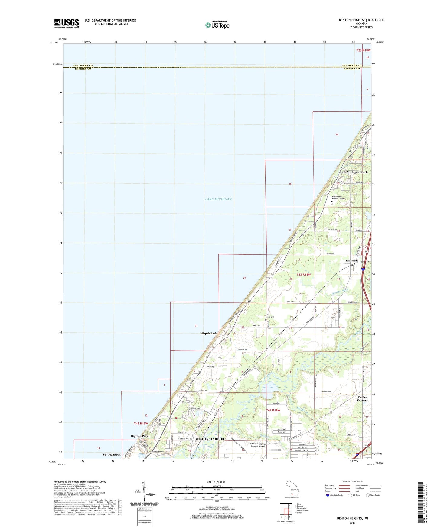
Benton Heights Michigan US Topo Map
Couldn't load pickup availability
2023 topographic map quadrangle Benton Heights in the state of Michigan. Scale: 1:24000. Based on the newly updated USGS 7.5' US Topo map series, this map is in the following counties: Berrien, Van Buren. The map contains contour data, water features, and other items you are used to seeing on USGS maps, but also has updated roads and other features. This is the next generation of topographic maps. Printed on high-quality waterproof paper with UV fade-resistant inks.
Quads adjacent to this one:
Northeast: Covert
East: Coloma
Southeast: Sodus
South: Benton Harbor
Southwest: Stevensville
This map covers the same area as the classic USGS quad with code o42086b4.
Contains the following named places: Benton Charter Township Fire Department Station 2, Benton Heights, Benton Heights Church of God, Blue Creek, Community of Christ Church, Crate Basket and Veneer Machinery Museum, Damon Lake, Eaman School, First Free Will Baptist Church, General Baptist Church, Granger Drain, Hagar Post Office, Higman Park, Jean Klock Park, Lake Michigan Beach Census Designated Place, Lake Michigan Beach Community Church, Lake Shore Cemetery, Martindale School, Mizpah Park, North Shore Estates Mobile Home Park, North Shore Memory Garden, North Shore School, Pier School, Riverside, Riverside Post Office, Riverside Station, Riverside United Methodist Church, Rocky Gap Park, Saint Marys Church, Sand Creek, School Number 6, Southwest Michigan Regional Airport, Tower Hill Park, Township of Hagar, Trinity Church of God in Christ, Twelve Corners, Twelve Corners Community Church, Twelve Corners Post Office, Zion Temple Church of God in Christ, ZIP Code: 49084