MyTopo
Angle Inlet Minnesota US Topo Map
Couldn't load pickup availability
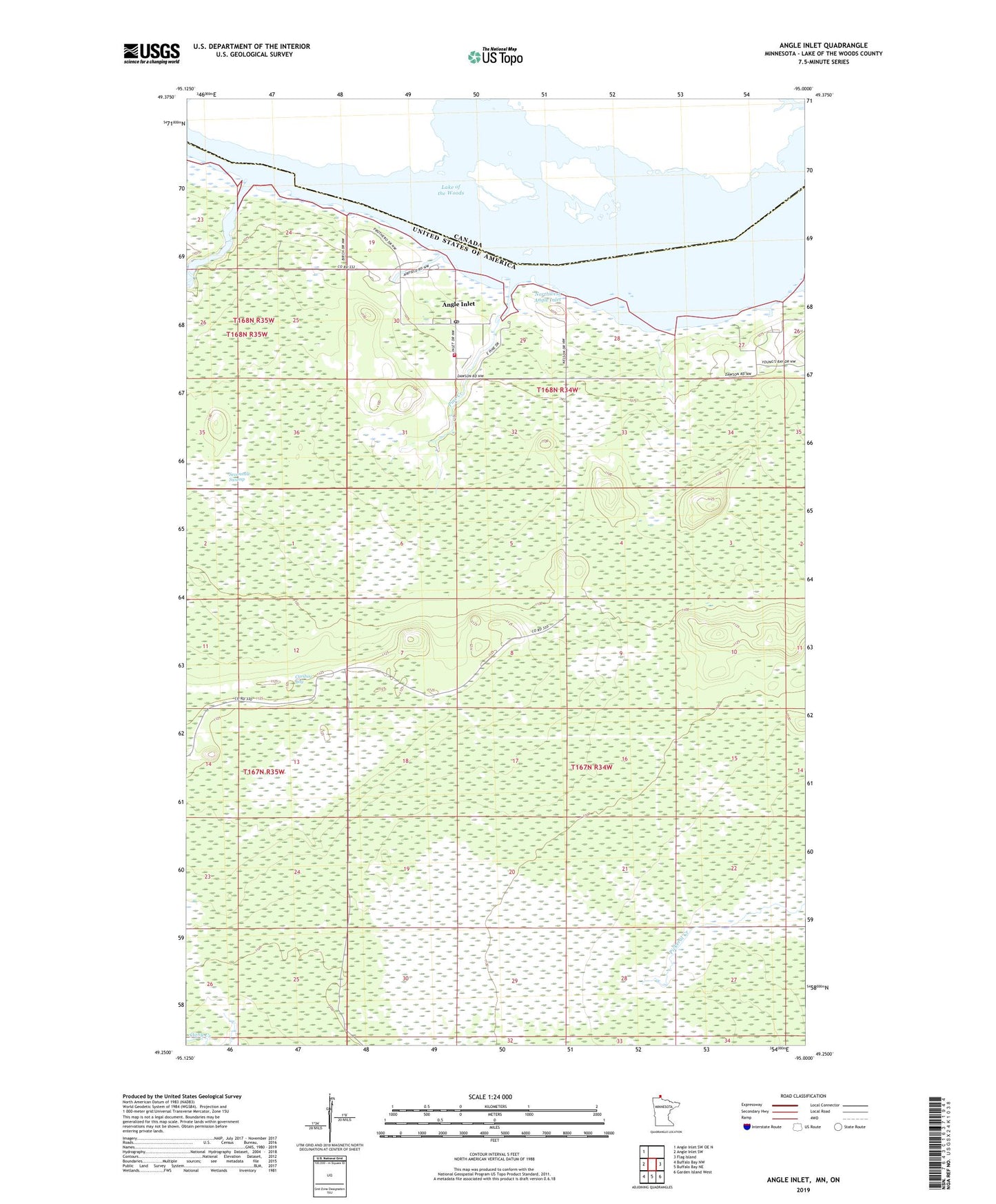
2019 topographic map quadrangle Angle Inlet in the state of Minnesota. Scale: 1:24000. Based on the newly updated USGS 7.5' US Topo map series, this map is in the following counties: Lake of the Woods. The map contains contour data, water features, and other items you are used to seeing on USGS maps, but also has updated roads and other features. This is the next generation of topographic maps. Printed on high-quality waterproof paper with UV fade-resistant inks.
Quads adjacent to this one:
West: Angle Inlet SW
Northwest: Angle Inlet SW OE N
East: Flag Island
Southeast: Garden Island West
South: Buffalo Bay NE
Southwest: Buffalo Bay NW
Contains the following named places: Angle Inlet, Angle Inlet Census Designated Place, Angle Inlet Post Office, Angle Inlet School, Caribou Bog, Crow Creek, Northwest Angle Airport, Northwest Angle Inlet, Northwest Angle Volunteer Fire Department, Pine Creek, Poplar Creek, Sevenmile Swamp