MyTopo
Flag Island Minnesota US Topo Map
Couldn't load pickup availability
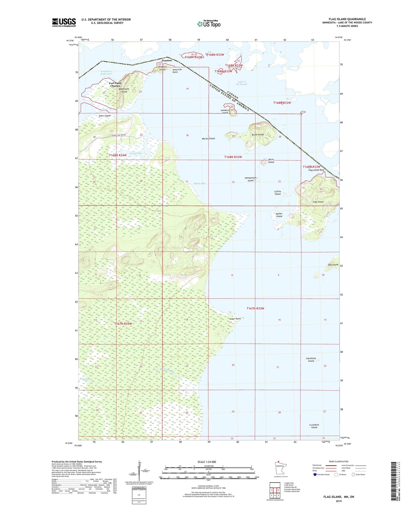
2022 topographic map quadrangle Flag Island in the state of Minnesota. Scale: 1:24000. Based on the newly updated USGS 7.5' US Topo map series, this map is in the following counties: Lake of the Woods. The map contains contour data, water features, and other items you are used to seeing on USGS maps, but also has updated roads and other features. This is the next generation of topographic maps. Printed on high-quality waterproof paper with UV fade-resistant inks.
Quads adjacent to this one:
West: Angle Inlet
East: Oak Island
Southeast: Garden Island East
South: Garden Island West
Southwest: Buffalo Bay NE
This map covers the same area as the classic USGS quad with code o49094c8.
Contains the following named places: American Point, Birch Island, Brush Island, Collins Island, Crowduck Island, Dahler Island, Ester Island, Flag Island, Flag Island Reef, Fort Saint Charles, Fourblock Island, Honeymoon Island, Lake Trails Church Camp, Lambert Island, Magnusons Island, Maries Island, Moose Bay, Northwest Angle State Forest, Penasse, Penasse Island, Penasse Post Office, Pickeral Creek, Pierre Gaultier De Varennes-Sieur De La Verendrye Historical Marker, Sugar Point, Sugar Point Post Office, Unorganized Territory of District 5, Youngs Bay, ZIP Code: 56711