MyTopo
Barnum Minnesota US Topo Map
Couldn't load pickup availability
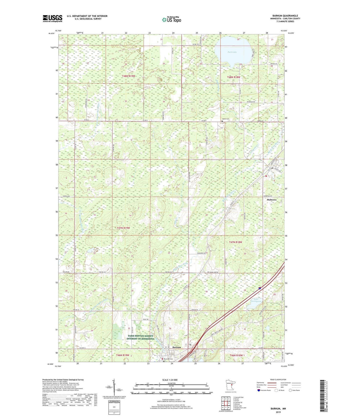
2019 topographic map quadrangle Barnum in the state of Minnesota. Scale: 1:24000. Based on the newly updated USGS 7.5' US Topo map series, this map is in the following counties: Carlton. The map contains contour data, water features, and other items you are used to seeing on USGS maps, but also has updated roads and other features. This is the next generation of topographic maps. Printed on high-quality waterproof paper with UV fade-resistant inks.
Quads adjacent to this one:
West: Cromwell SE
Northwest: Cromwell East
North: Sawyer
Northeast: Iverson
East: Atkinson
Southeast: Nickerson
South: Hanging Horn Lake
Southwest: Moose Lake
Contains the following named places: Barnum, Barnum City Park, Barnum City Park Campground, Barnum Elementary School, Barnum High School, Barnum Mobile Home Park, Barnum Post Office, Barnum United Methodist Church, Barnum Volunteer Fire Department, Carlton County, City of Barnum, Emmanuel Lutheran Church, Jehovah's Witnesses Congregation, Jesus Center Church, King Creek, Lake Twentynine, Mahtowa, Mahtowa Census Designated Place, Mahtowa Covenant Church, Mahtowa Fire Department, Mahtowa Post Office, Ninefeldt Pool, Ninefeldt Pool Dam, Park Lake, Park Lake Creek, Park Lake Dam, Salem Cemetery, Salem Lutheran Church, Township of Skelton, Twentynine Pines Country Club, West Fork Moose Horn River, ZIP Code: 55707