MyTopo
Atkinson Minnesota US Topo Map
Couldn't load pickup availability
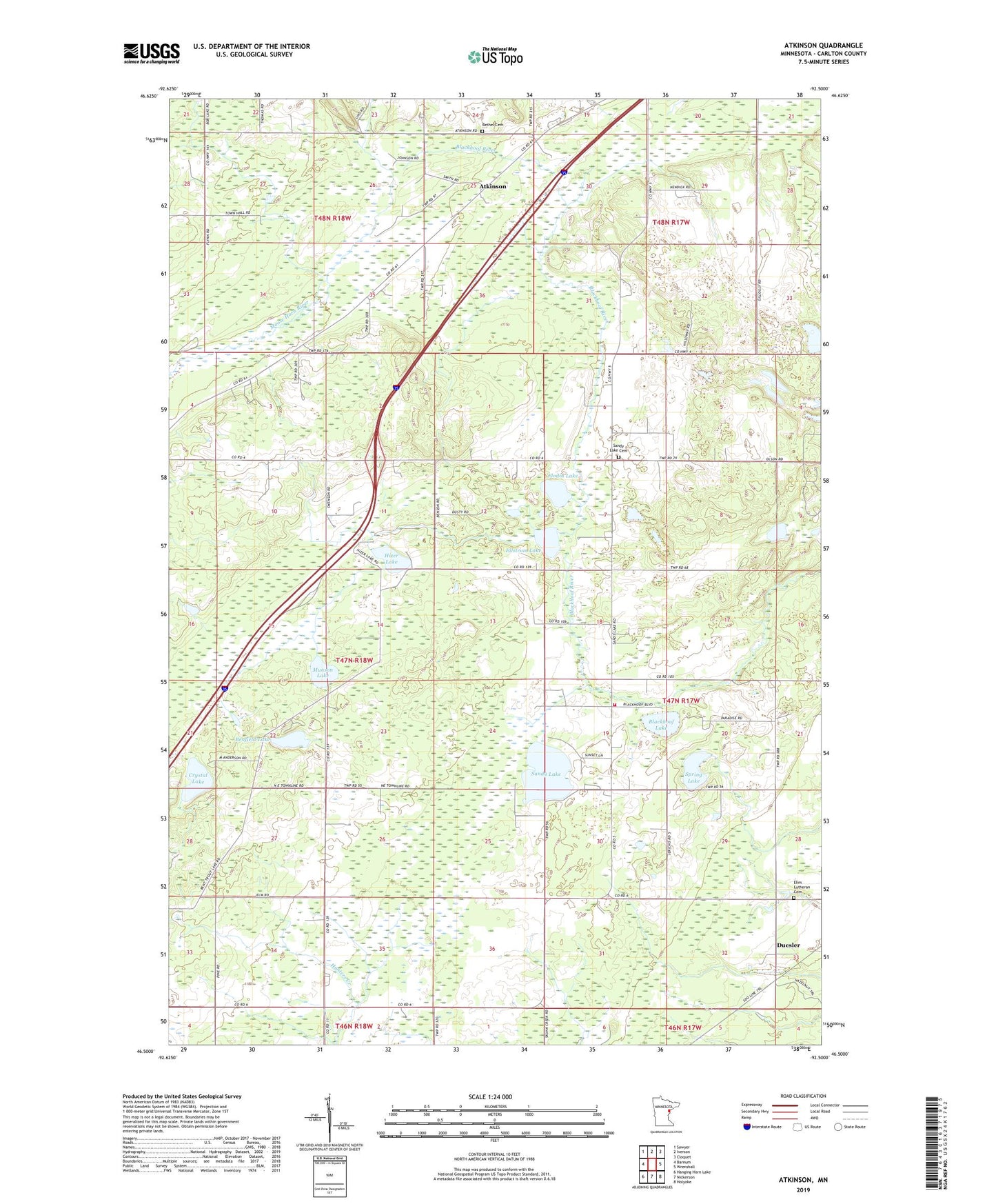
2022 topographic map quadrangle Atkinson in the state of Minnesota. Scale: 1:24000. Based on the newly updated USGS 7.5' US Topo map series, this map is in the following counties: Carlton. The map contains contour data, water features, and other items you are used to seeing on USGS maps, but also has updated roads and other features. This is the next generation of topographic maps. Printed on high-quality waterproof paper with UV fade-resistant inks.
Quads adjacent to this one:
West: Barnum
Northwest: Sawyer
North: Iverson
Northeast: Cloquet
East: Wrenshall
Southeast: Holyoke
South: Nickerson
Southwest: Hanging Horn Lake
This map covers the same area as the classic USGS quad with code o46092e5.
Contains the following named places: Atkinson, Atkinson Post Office, Benfield Lake, Bent Trout Lake Campground, Bethel Cemetery, Blackhoof Fire Department, Blackhoof Lake, Blackhoof Valley School, Brethren Church, Central School, Crystal Lake, Culkin North Bound Rest Area, Duesler, Duesler Post Office, Elim Church, Elim Lutheran Cemetery, Ellstrom Lake, Flodin Lake, Hizer Lake, Iron Range Historical Marker, Munson Lake, Pentecost Church, Sandy Lake, Sandy Lake Cemetery, Sandy Lake Church, Spring Lake, Township of Atkinson, Township of Mahtowa, Zion Church