
MyTopo
Benedict Minnesota US Topo Map
Couldn't load pickup availability
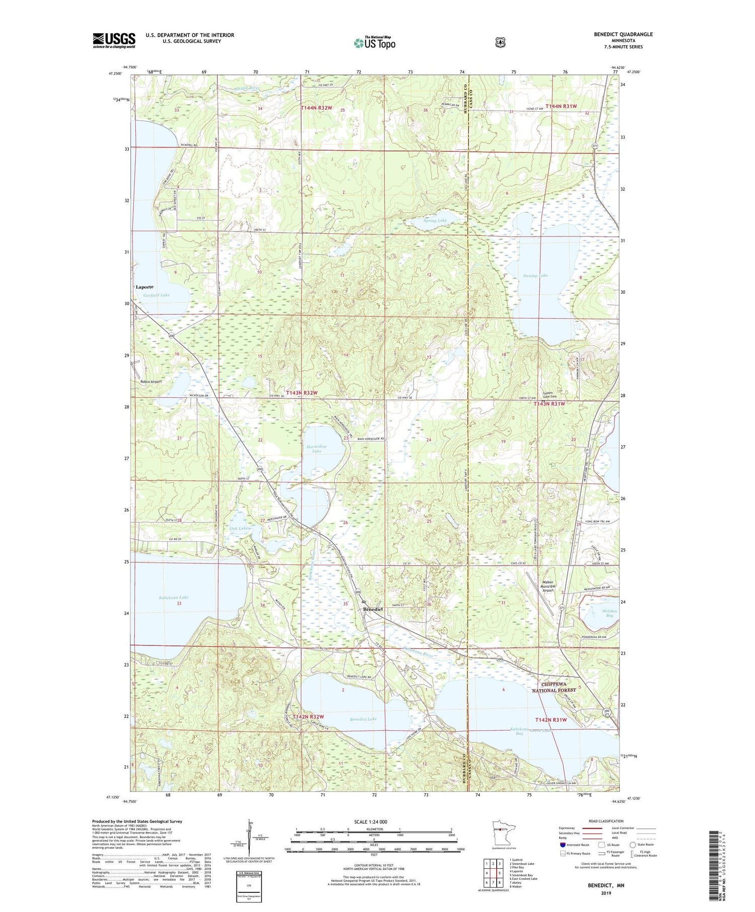
2019 topographic map quadrangle Benedict in the state of Minnesota. Scale: 1:24000. Based on the newly updated USGS 7.5' US Topo map series, this map is in the following counties: Hubbard, Cass. The map contains contour data, water features, and other items you are used to seeing on USGS maps, but also has updated roads and other features. This is the next generation of topographic maps. Printed on high-quality waterproof paper with UV fade-resistant inks.
Quads adjacent to this one:
West: Laporte
Northwest: Guthrie
North: Steamboat Lake
Northeast: Pike Bay
East: Steamboat Bay
Southeast: Walker
South: Akeley
Southwest: East Crooked Lake
Contains the following named places: Benedict, Benedict Lake, Benedict Post Office, Benedict Railroad Station, Garfield Lake, Golden Gate Cemetery, Horseshoe Lake, Kabekona River, Leech Lake, Leech Lake Post Office, Morrill Landing Strip, Oak Lake, Spring Lake, Swamp Lake, Township of Lakeport, Walker Municipal Airport, Walker Rest Area, Water's Edge RV Park, Wedgewood Golf Course, ZIP Code: 56436


