MyTopo
Guthrie Minnesota US Topo Map
Couldn't load pickup availability
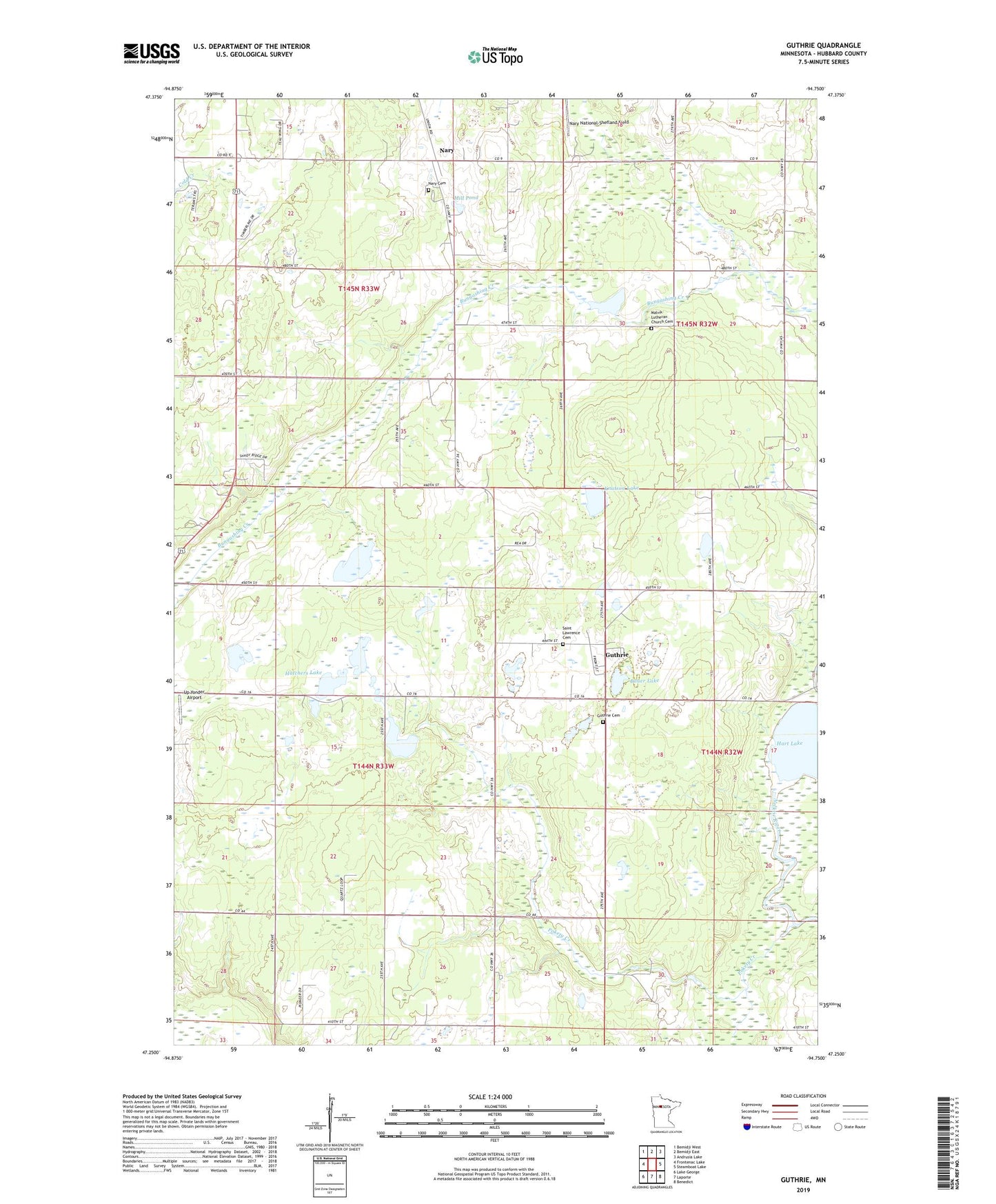
2022 topographic map quadrangle Guthrie in the state of Minnesota. Scale: 1:24000. Based on the newly updated USGS 7.5' US Topo map series, this map is in the following counties: Hubbard. The map contains contour data, water features, and other items you are used to seeing on USGS maps, but also has updated roads and other features. This is the next generation of topographic maps. Printed on high-quality waterproof paper with UV fade-resistant inks.
Quads adjacent to this one:
West: Frontenac Lake
Northwest: Bemidji West
North: Bemidji East
Northeast: Andrusia Lake
East: Steamboat Lake
Southeast: Benedict
South: Laporte
Southwest: Lake George
This map covers the same area as the classic USGS quad with code o47094c7.
Contains the following named places: Bauer Lake, Guthrie, Guthrie Bible Chapel, Guthrie Cemetery, Guthrie Post Office, Guthrie Railroad Station, Hart Lake, Hatchers Lake, Horsehead Lake, Knutson Lake, Malvik Church, Malvik Lutheran Church Cemetery, Mill Pond, Nary, Nary Cemetery, Nary National-Shefland Field, Nary Post Office, Pokety Creek, Saint Lawrence Cemetery, Township of Guthrie, Township of Helga, Up Yonder Airport