MyTopo
Bernadotte Minnesota US Topo Map
Couldn't load pickup availability
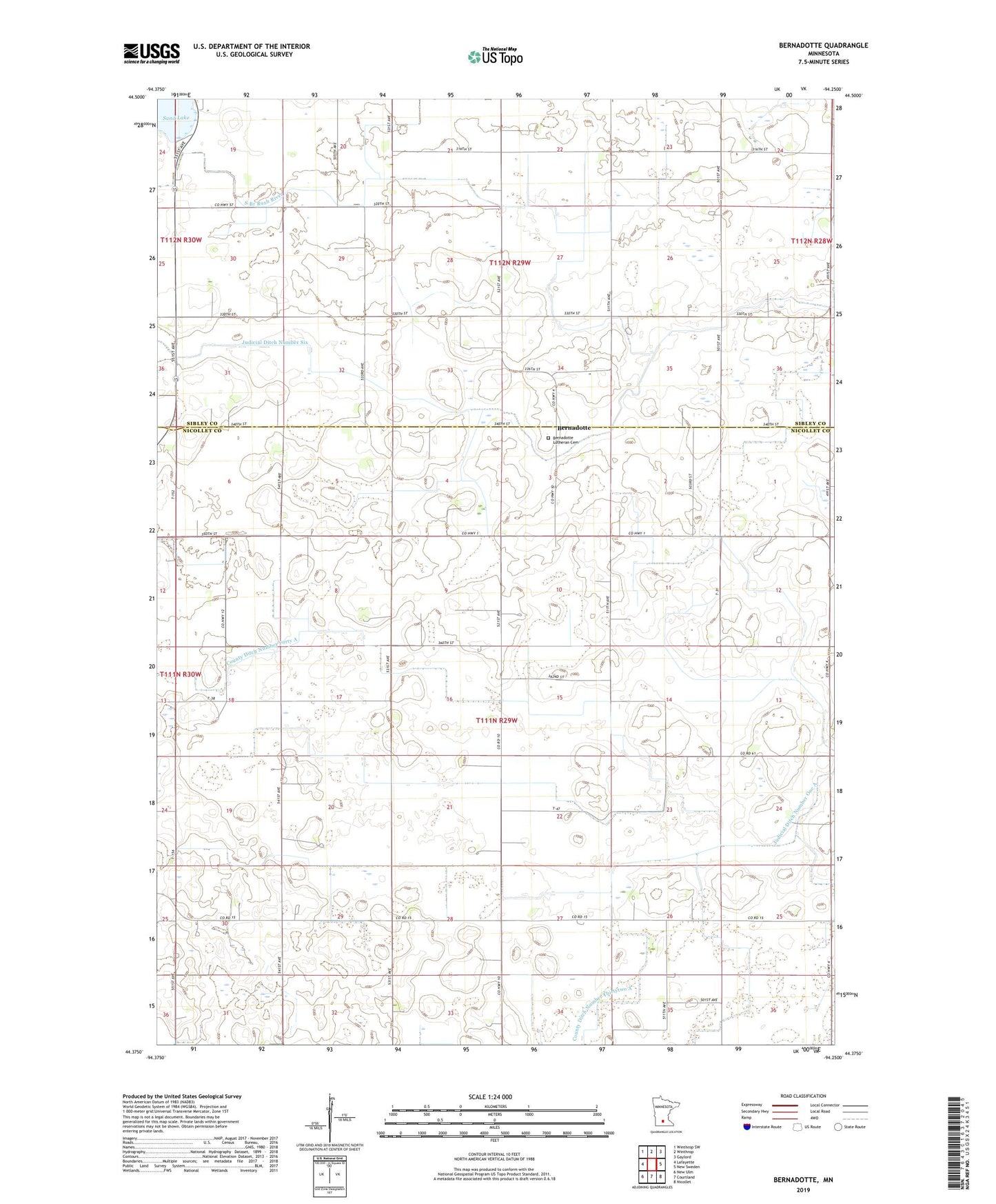
2019 topographic map quadrangle Bernadotte in the state of Minnesota. Scale: 1:24000. Based on the newly updated USGS 7.5' US Topo map series, this map is in the following counties: Nicollet, Sibley. The map contains contour data, water features, and other items you are used to seeing on USGS maps, but also has updated roads and other features. This is the next generation of topographic maps. Printed on high-quality waterproof paper with UV fade-resistant inks.
Quads adjacent to this one:
West: Lafayette
Northwest: Winthrop SW
North: Winthrop
Northeast: Gaylord
East: New Sweden
Southeast: Nicollet
South: Courtland
Southwest: New Ulm
Contains the following named places: Bernadotte, Bernadotte Lutheran Cemetery, Bernadotte Lutheran Church, Bernadotte Post Office, County Ditch Number Five, County Ditch Number Forty A, County Ditch Number Nine, County Ditch Number Thirtytwo A, Judicial Ditch Number Six, Sand Lake, Sand Lake Wayside Park, Township of Alfsborg, Township of Bernadotte, ZIP Code: 56054