MyTopo
Beroun Minnesota US Topo Map
Couldn't load pickup availability
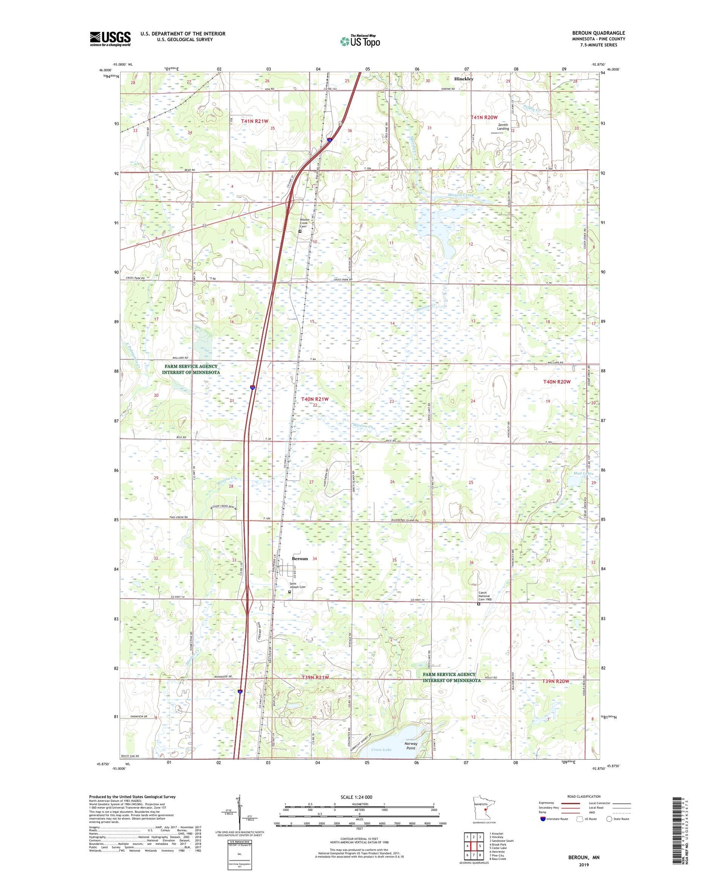
2019 topographic map quadrangle Beroun in the state of Minnesota. Scale: 1:24000. Based on the newly updated USGS 7.5' US Topo map series, this map is in the following counties: Pine. The map contains contour data, water features, and other items you are used to seeing on USGS maps, but also has updated roads and other features. This is the next generation of topographic maps. Printed on high-quality waterproof paper with UV fade-resistant inks.
Quads adjacent to this one:
West: Brook Park
Northwest: Kroschel
North: Hinckley
Northeast: Sandstone South
East: Cedar Lake
Southeast: Bass Creek
South: Pine City
Southwest: Henriette
Contains the following named places: Beroun, Czech National Cemetery 1900, Lawrence Mans Dam, Lawrence Mans Reservoir, Mission Creek, Mission Creek Cemetery, Mud Lake, Norway Point, Pavek Airport, Saint Joseph Cemetery, School Number 1570, School Number 1577, School Number 1594, Township of Mission Creek, WCMP-FM (Pine City), Zenith Landing