MyTopo
Cedar Lake Minnesota US Topo Map
Couldn't load pickup availability
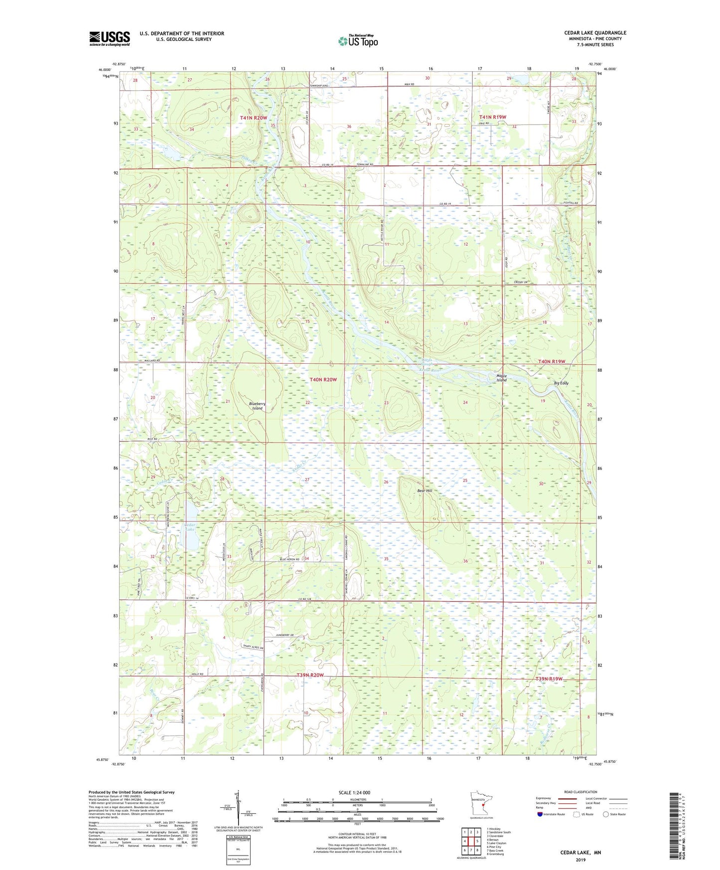
2022 topographic map quadrangle Cedar Lake in the state of Minnesota. Scale: 1:24000. Based on the newly updated USGS 7.5' US Topo map series, this map is in the following counties: Pine. The map contains contour data, water features, and other items you are used to seeing on USGS maps, but also has updated roads and other features. This is the next generation of topographic maps. Printed on high-quality waterproof paper with UV fade-resistant inks.
Quads adjacent to this one:
West: Beroun
Northwest: Hinckley
North: Sandstone South
Northeast: Cloverdale
East: Lake Clayton
Southeast: Grantsburg
South: Bass Creek
Southwest: Pine City
This map covers the same area as the classic USGS quad with code o45092h7.
Contains the following named places: Bear Hill, Big Eddy, Blueberry Island, Calvin Harth Wildlife Structure Dam, Cedar Creek, Cedar Lake, Chengwatana State Forest, Lords Slough, Maple Island, Pelkey Creek, Township of Munch