MyTopo
Bowlus Minnesota US Topo Map
Couldn't load pickup availability
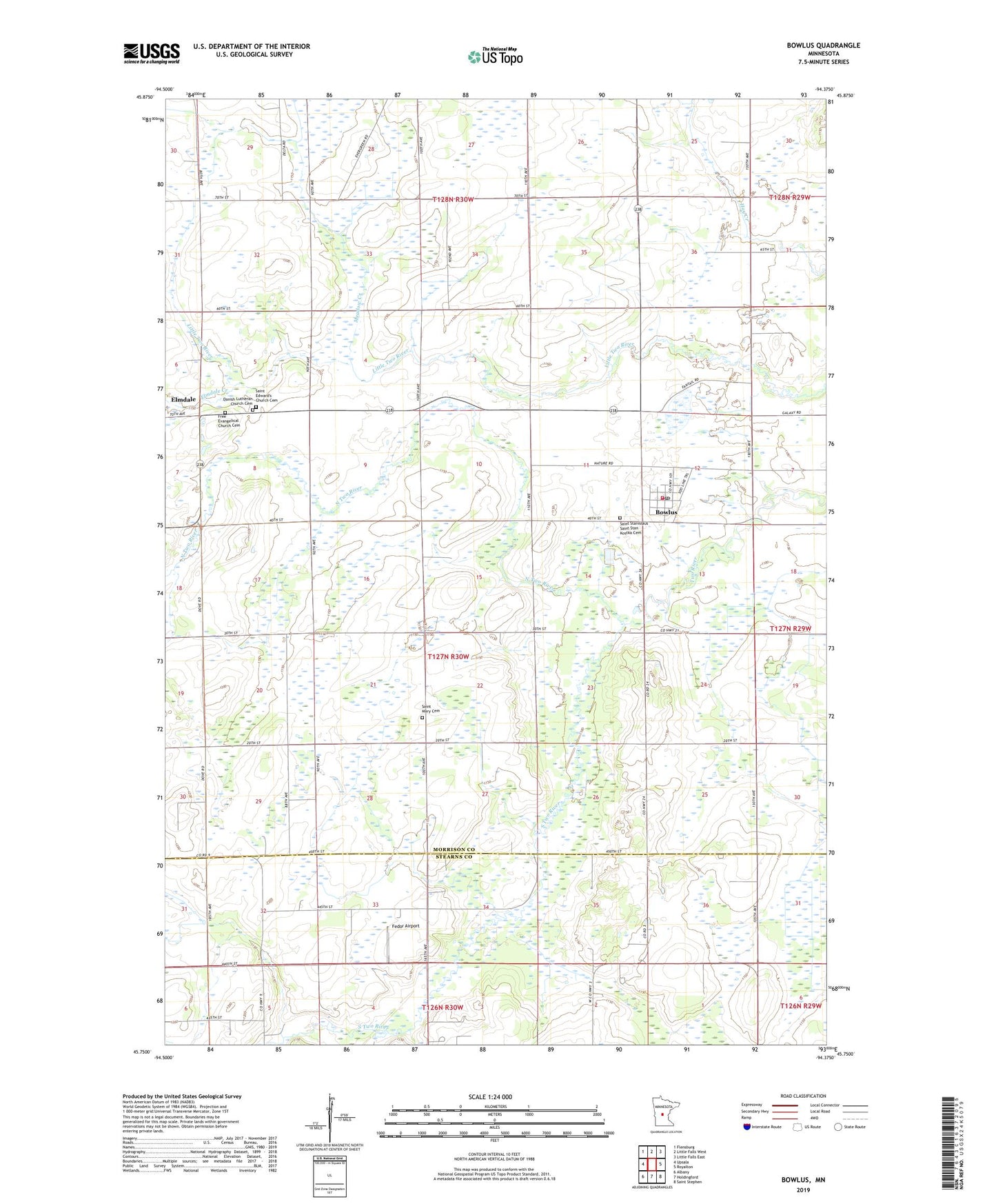
2019 topographic map quadrangle Bowlus in the state of Minnesota. Scale: 1:24000. Based on the newly updated USGS 7.5' US Topo map series, this map is in the following counties: Morrison, Stearns. The map contains contour data, water features, and other items you are used to seeing on USGS maps, but also has updated roads and other features. This is the next generation of topographic maps. Printed on high-quality waterproof paper with UV fade-resistant inks.
Quads adjacent to this one:
West: Upsala
Northwest: Flensburg
North: Little Falls West
Northeast: Little Falls East
East: Royalton
Southeast: Saint Stephen
South: Holdingford
Southwest: Albany
Contains the following named places: Bowlus, Bowlus Fire Department, Bowlus Post Office, City of Bowlus, City of Elmdale, Danish Lutheran Church Cemetery, Elmdale, Elmdale Creek, Elmdale Post Office, Fedor Airport, Free Evangelical Church Cemetery, Meadow Creek, North Two River, Saint Edward's Church Cemetery, Saint Mary Cemetery, Saint Mary Church, Saint Stanislaus Church, Saint Stanislaus Saint Stan Kostka Cemetery, South Elmdale Church, South Two River, Township of Two Rivers, ZIP Codes: 56314, 56340