MyTopo
Little Falls West Minnesota US Topo Map
Couldn't load pickup availability
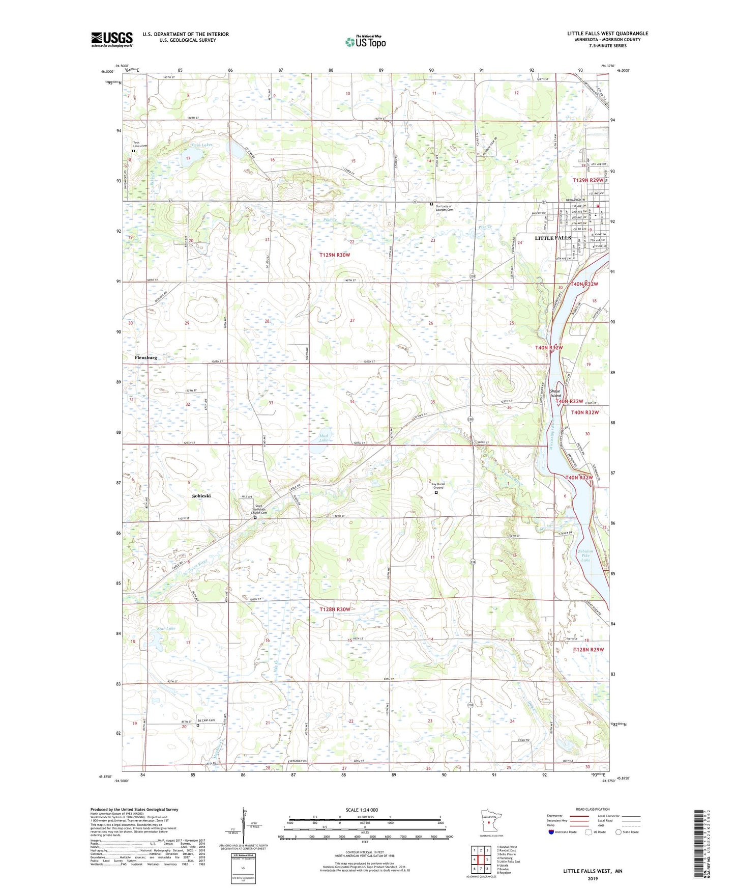
2022 topographic map quadrangle Little Falls West in the state of Minnesota. Scale: 1:24000. Based on the newly updated USGS 7.5' US Topo map series, this map is in the following counties: Morrison. The map contains contour data, water features, and other items you are used to seeing on USGS maps, but also has updated roads and other features. This is the next generation of topographic maps. Printed on high-quality waterproof paper with UV fade-resistant inks.
Quads adjacent to this one:
West: Flensburg
Northwest: Randall West
North: Randall East
Northeast: Belle Prairie
East: Little Falls East
Southeast: Royalton
South: Bowlus
Southwest: Upsala
This map covers the same area as the classic USGS quad with code o45094h4.
Contains the following named places: Charles A Lindbergh House, Charles A Lindbergh State Park, Charles A Weyerhaeuser Museum, City of Sobieski, Ed Cash Cemetery, Jaycee Park, Kay Burial Ground, Kiwanis Ball Fields, Lincoln Elementary School, Lindbergh House Historical Marker, Little Falls Country Club, Little Falls Fire Department Station 2, Mud Lake, Our Lady of Lourdes Cemetery, Pike Creek, Pine Grove Park, Pine Grove Zoo, Saint Stanislaus Church Cemetery, Shayes Island, Sobieski, Star Lake, Swan River, Township of Pike Creek, Township of Swan River, Twin Lakes, Twin Lakes Cemetery