MyTopo
Butterfield Minnesota US Topo Map
Couldn't load pickup availability
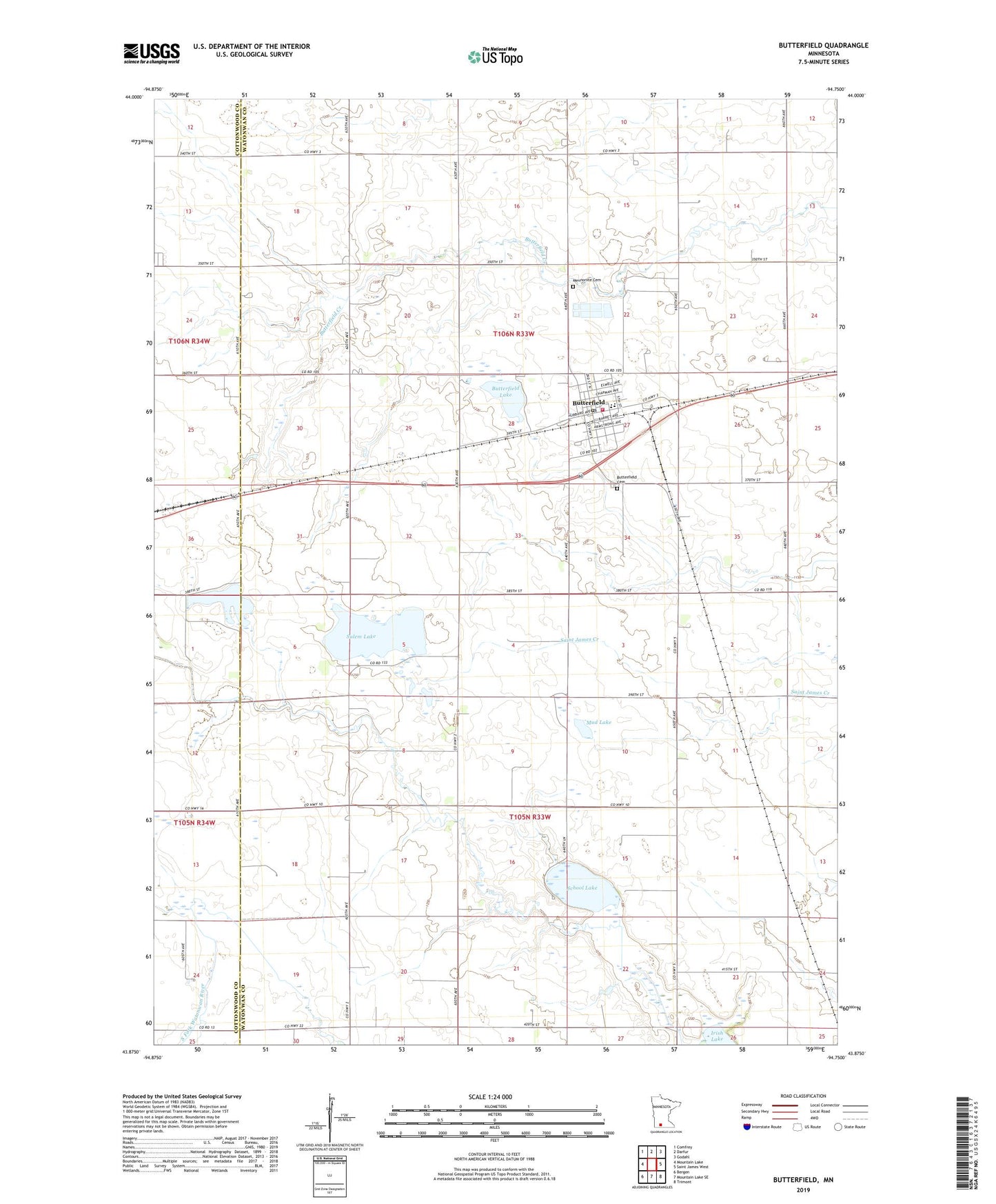
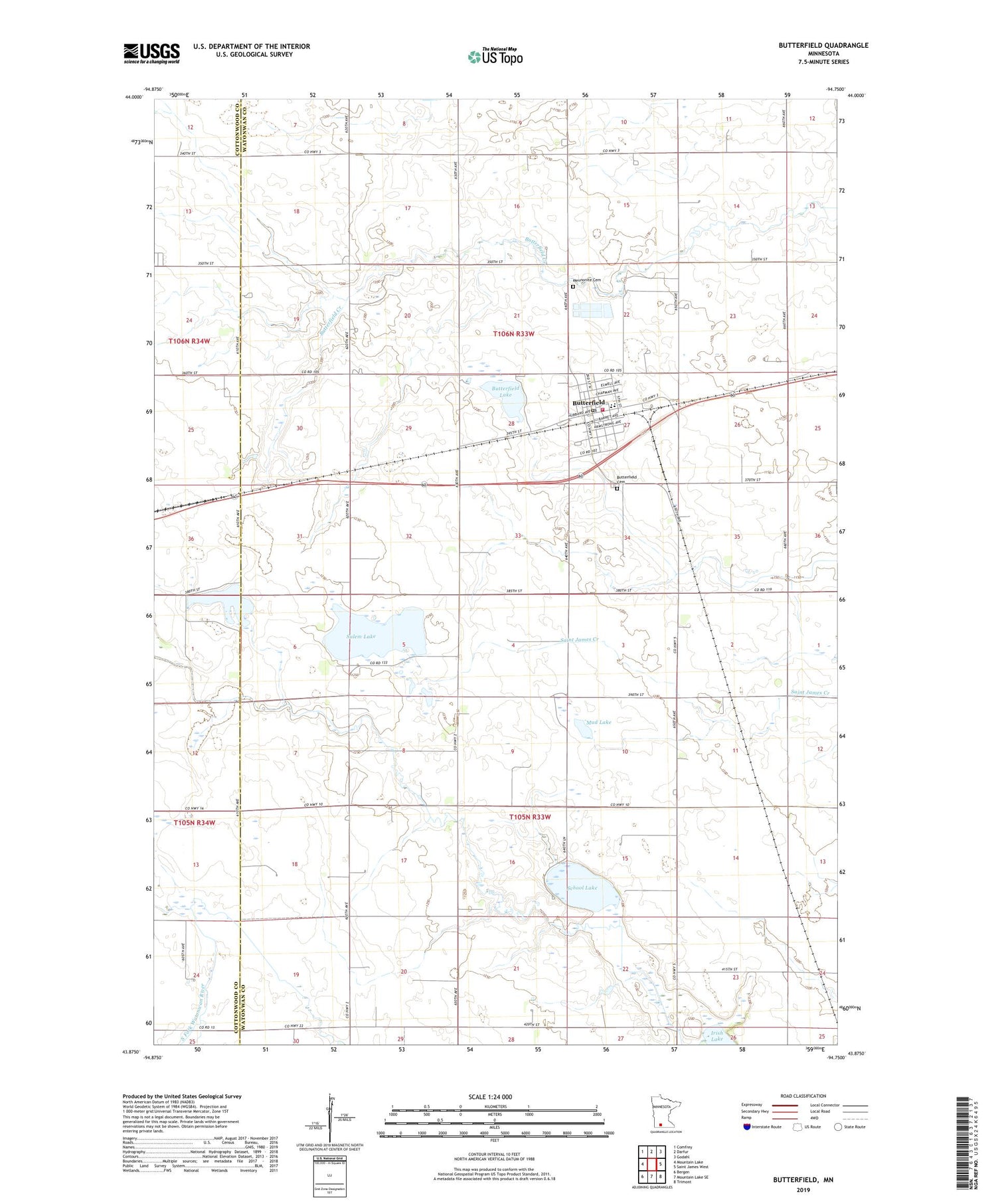
2019 topographic map quadrangle Butterfield in the state of Minnesota. Scale: 1:24000. Based on the newly updated USGS 7.5' US Topo map series, this map is in the following counties: Watonwan, Cottonwood. The map contains contour data, water features, and other items you are used to seeing on USGS maps, but also has updated roads and other features. This is the next generation of topographic maps. Printed on high-quality waterproof paper with UV fade-resistant inks.
Quads adjacent to this one:
West: Mountain Lake
Northwest: Comfrey
North: Darfur
Northeast: Godahl
East: Saint James West
Southeast: Trimont
South: Mountain Lake SE
Southwest: Bergen
Contains the following named places: Butterfield, Butterfield Cemetery, Butterfield City Hall, Butterfield Lake, Butterfield Library, Butterfield Mennonite Church, Butterfield Post Office, Butterfield Public School, Butterfield Volunteer Fire Department, City of Butterfield, First Lutheran Church, Judicial Ditch Number One, Mennonite Cemetery, Mud Lake, Regehr State Wildlife Management Area, Saint John Evangelical Lutheran Church, Saint Matthew's Evangelical Church, School Lake, Sulem Lake, Township of Butterfield, Township of Odin, Voss Park, Voss Park Campground, ZIP Code: 56120