MyTopo
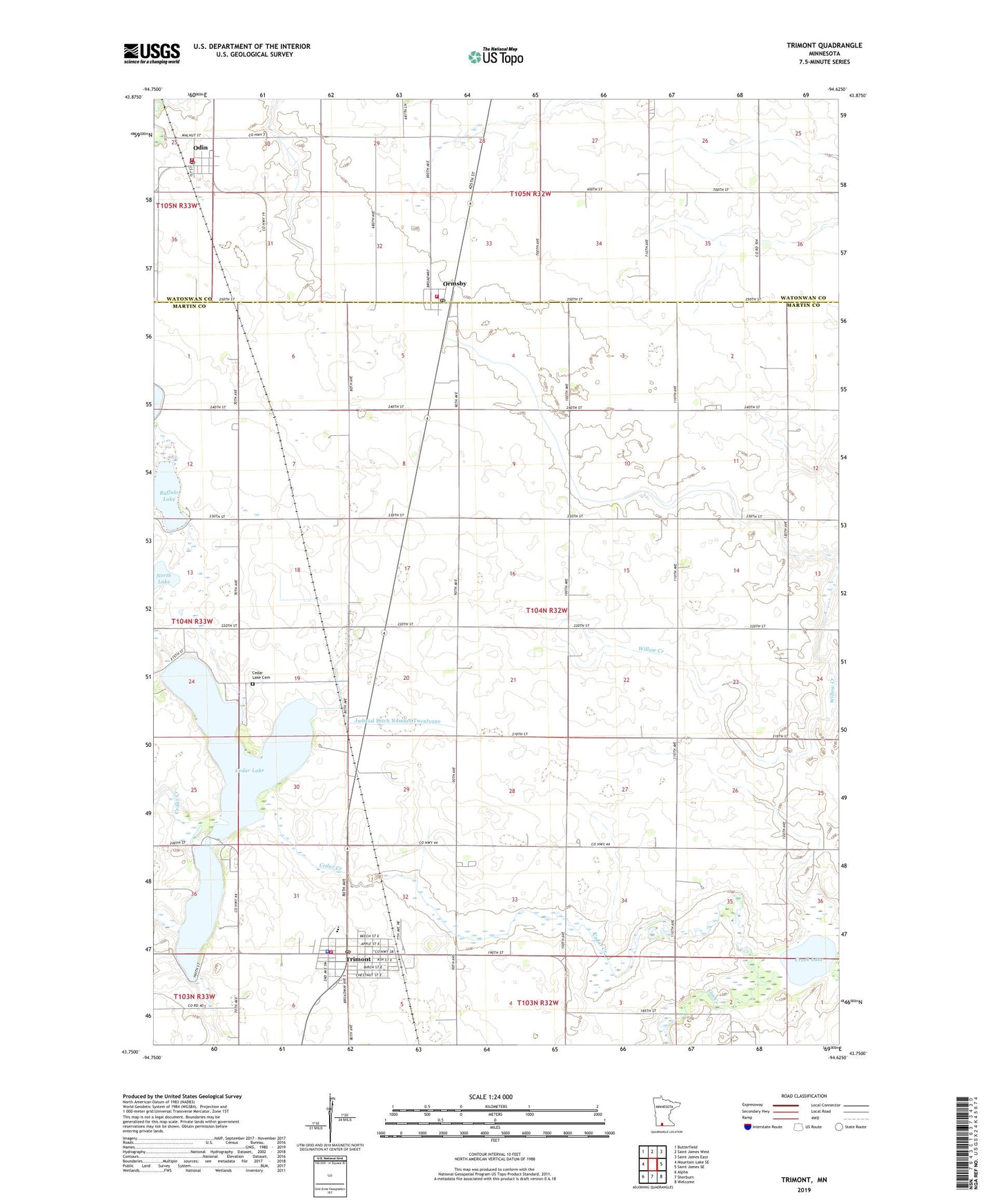
Trimont Minnesota US Topo Map
Couldn't load pickup availability
2022 topographic map quadrangle Trimont in the state of Minnesota. Scale: 1:24000. Based on the newly updated USGS 7.5' US Topo map series, this map is in the following counties: Martin, Watonwan. The map contains contour data, water features, and other items you are used to seeing on USGS maps, but also has updated roads and other features. This is the next generation of topographic maps. Printed on high-quality waterproof paper with UV fade-resistant inks.
Quads adjacent to this one:
West: Mountain Lake SE
Northwest: Butterfield
North: Saint James West
Northeast: Saint James East
East: Saint James SE
Southeast: Welcome
South: Sherburn
Southwest: Alpha
This map covers the same area as the classic USGS quad with code o43094g6.
Contains the following named places: Buffalo Lake, Cedar Creek, Cedar Lake, Cedar Lake Cemetery, City of Odin, City of Ormsby, City of Trimont, Creek Lake, Evangelical Covenant Church, First Lutheran Church, Immanuel Church, Judicial Ditch Number Eightytwo, Judicial Ditch Number Four, Judicial Ditch Number Thirtynine, Judicial Ditch Number Twentyone, Judicial Ditch Number Two, Methodist Church, Mountain County West Junior High School, North Lake, Odin, Odin Fire Department, Odin Library, Odin Post Office, Odin Town Hall, Ormsby, Ormsby Fire Department, Ormsby Post Office, Saint Olaf Lutheran Church, Township of Galena, Trimont, Trimont City Library, Trimont Family Practice Clinic, Trimont Fire Department and Ambulance Service, Trimont Health Care Center, Trimont Nursing Home, Trimont Police Department, Trimont Post Office, Trinity Lutheran Church, Triumph Post Office, Zion Lutheran Church, ZIP Codes: 56162, 56176