
MyTopo
Cabin Lake Minnesota US Topo Map
Couldn't load pickup availability
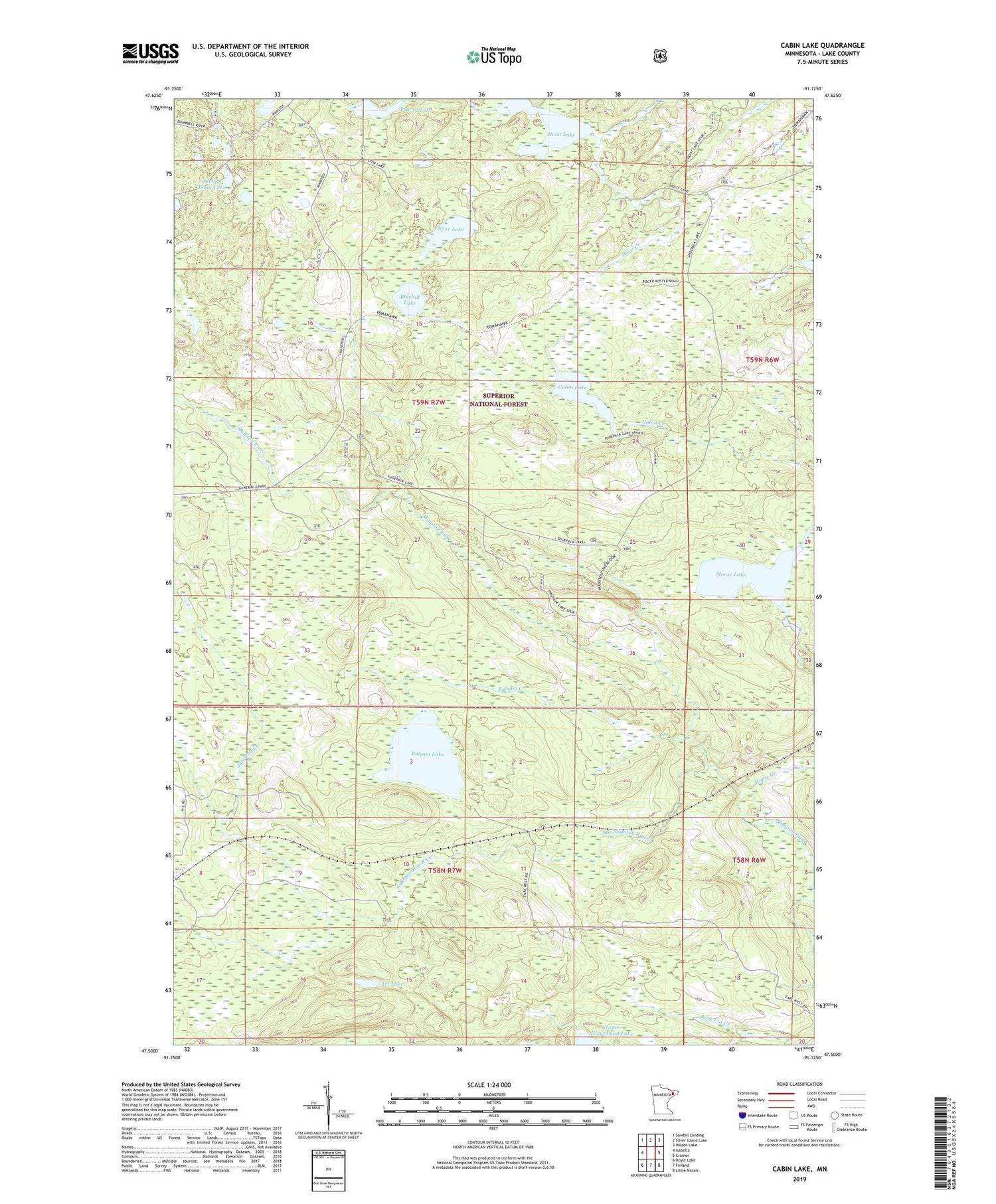
2019 topographic map quadrangle Cabin Lake in the state of Minnesota. Scale: 1:24000. Based on the newly updated USGS 7.5' US Topo map series, this map is in the following counties: Lake. The map contains contour data, water features, and other items you are used to seeing on USGS maps, but also has updated roads and other features. This is the next generation of topographic maps. Printed on high-quality waterproof paper with UV fade-resistant inks.
Quads adjacent to this one:
West: Isabella
Northwest: Sawbill Landing
North: Silver Island Lake
Northeast: Wilson Lake
East: Cramer
Southeast: Little Marais
South: Finland
Southwest: Doyle Lake
Contains the following named places: Art Lake, Balsam Creek, Balsam Lake, Bluebill Lake, Cabin Creek, Cabin Lake, Hoist Creek, Hoist Lake, Junction Creek, Moose Creek, Moose Lake, Peavey Lake, Rock Cut Creek, Section Eight Lake, South Branch Manitou River, Spur Lake


