MyTopo
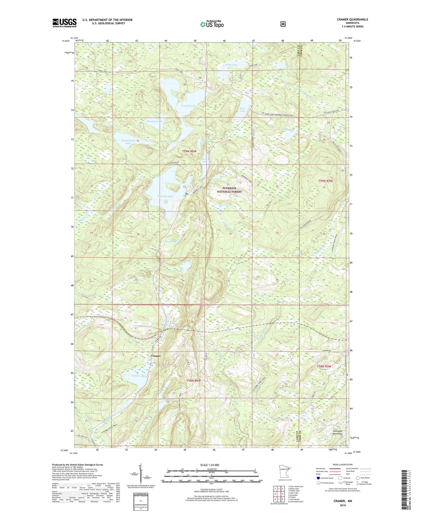
Cramer Minnesota US Topo Map
Couldn't load pickup availability
Also explore the Cramer Forest Service Topo of this same quad for updated USFS data
2022 topographic map quadrangle Cramer in the state of Minnesota. Scale: 1:24000. Based on the newly updated USGS 7.5' US Topo map series, this map is in the following counties: Lake, Cook. The map contains contour data, water features, and other items you are used to seeing on USGS maps, but also has updated roads and other features. This is the next generation of topographic maps. Printed on high-quality waterproof paper with UV fade-resistant inks.
Quads adjacent to this one:
West: Cabin Lake
Northwest: Silver Island Lake
North: Wilson Lake
Northeast: Toohey Lake
East: Schroeder
Southeast: Little Marais OE E
South: Little Marais
Southwest: Finland
This map covers the same area as the classic USGS quad with code o47091e1.
Contains the following named places: Amenda Creek, Artlip Lake, Bonanza Lake, Cramer, Cramer Lake, Crooked Lake, Echo Lake, George H Crosby Manitou State Park, Goldeneye Lake, Hare Lake, Kowalski Lake, Martin Creek, Meme Lake, Morris Lake, Ninemile Campground, Ninemile Creek, Ninemile Lake, Paccini Lake, Pearl Lake, Shoepack Lake, Thunderbird Lake