MyTopo
Calumet Minnesota US Topo Map
Couldn't load pickup availability
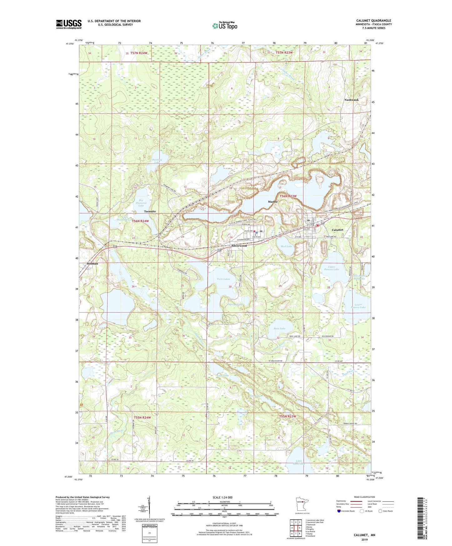
2019 topographic map quadrangle Calumet in the state of Minnesota. Scale: 1:24000. Based on the newly updated USGS 7.5' US Topo map series, this map is in the following counties: Itasca. The map contains contour data, water features, and other items you are used to seeing on USGS maps, but also has updated roads and other features. This is the next generation of topographic maps. Printed on high-quality waterproof paper with UV fade-resistant inks.
Quads adjacent to this one:
West: Bovey
Northwest: Lawrence Lake West
North: Lawrence Lake East
Northeast: Nashwauk
East: Pengilly
Southeast: Goodland
South: Warba
Southwest: La Prairie
Contains the following named places: Arcturus Mine, Barbara Mine, Bass Lake, Big Diamond Lake, Calumet, Calumet City Hall, Calumet Community Presbyterian Church, Calumet Fire Department, Calumet Library, Calumet Post Office, City of Calumet, City of Marble, Dunning Lake, Foot Lake, Geology of the Hill Annex Mine Geological Marker, Grace English Lutheran Church, Gross -Marble Mine, Hill Annex Dike One, Hill Annex Dike Three, Hill -Annex Mine, Hill Annex Pond One, Hill Annex Pond Three, Hill Trumbull Mine, Holman, Holman Lake, Little Diamond Lake, Little Sand Lake, Loon Lake, Lower Panaca Lake, Majorca Mine, Marble, Marble Elementary School, Marble Fire Department, Marble Police Department, Marble Post Office, Marble Public Library, Mud Lake, Saint Mary's Catholic Church, Sal's Campground, Silverwood, Spring Lake, Township of Greenway, Twin Lake Trails Mobile Home Park, Twin Lakes, Upper Panaca Lake, ZIP Codes: 55716, 55764