MyTopo
Warba Minnesota US Topo Map
Couldn't load pickup availability
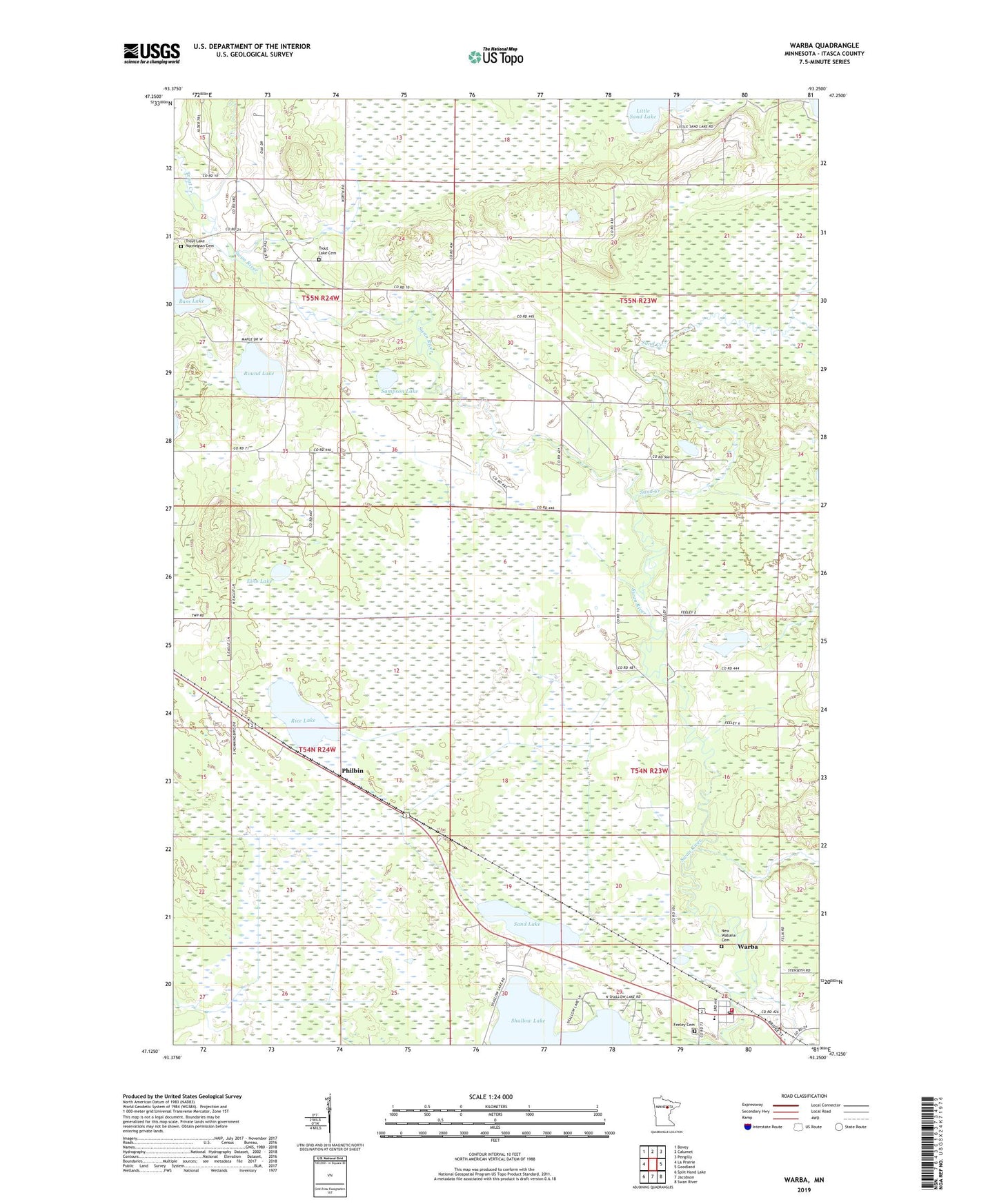
2022 topographic map quadrangle Warba in the state of Minnesota. Scale: 1:24000. Based on the newly updated USGS 7.5' US Topo map series, this map is in the following counties: Itasca. The map contains contour data, water features, and other items you are used to seeing on USGS maps, but also has updated roads and other features. This is the next generation of topographic maps. Printed on high-quality waterproof paper with UV fade-resistant inks.
Quads adjacent to this one:
West: La Prairie
Northwest: Bovey
North: Calumet
Northeast: Pengilly
East: Goodland
Southeast: Swan River
South: Jacobson
Southwest: Split Hand Lake
This map covers the same area as the classic USGS quad with code o47093b3.
Contains the following named places: Bethel Lutheran Church, City of Warba, Eino Lake, Feeley Cemetery, Legion Campground, Marrier Estates, New Wabana Cemetery, Philbin, Rice Lake, Round Lake, Sampson Lake, Sand Creek, Sand Lake, Shallow Lake, Spring Creek, Township of Feeley, Trout Creek, Trout Lake Cemetery, Trout Lake Church, Trout Lake Norwegian Cemetery, Unorganized Territory of Little Sand Lake, Warba, Warba - Feeley - Sago Fire Department, Warba Post Office